Region of Xizang (Tibet)
Altitude: 3836m/12,590ft. Population: 50,000
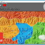
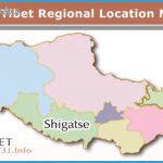
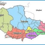
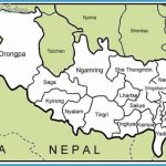
Xigaze lies in southern Tibet, 345km/214 miles west of Lhasa, the region’s capital, and some 500km/310 miles north-east of Katmandu, at 88°27’E and 29°14’N. It is linked to Lhasa and Katmandu by overland bus.
More than 500 years old, Xigaze is the second largest town in the Autonomous Region and has always been the political, religious and economic centre of southern Tibet.
On Mount Zongshan in the town there once stood a palace which served as a model for the Potala Palace in Lhasa. It was destroyed during the Cultural Revolution.
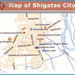
On the southern edge of town lies the Monastery of Tashihunpo (Mount of Eternal Blessing), built in 1447 and for a long time the place where the Panchen Lamas performed their political and religious tasks.
The complex of buildings, extended several times in the 17th and 18th c. and measuring 15ha/371/2 acres in area, houses a giant statue of the Buddha which stands 26m/85ft tall and is cast entirely in bronze. The monastery also includes several silvered dagobs (conical shrines) each containing the
Note particularly the magnificent wall-paintings in the chapel of the first Dalai Lama.
The monastery town of Palkhor, situated 120km/75 miles south-east of Xigaze near the town of Gyangze (Jiangzi) dates from the 14th c. and is known particularly for its octagonal stupa, the Chorten d’Or (Baijiao Ta). This contains a number of sculptures and frescos in Indian, Nepalese and Chinese styles.
A masterpiece of Tibetan architecture is the early 15th c. Kumbum Chorten, with a mandala-like circular ground plan. All kinds of sculptures and frescos are to be found in dozens of wall-niches.
Sakya Monastery stands 150km/93 miles south-west of Xigaze. The Tibetan word “sakya” means “greyish earth”, referring to the colour of the soil in this region. The monastery was the centre ofthe Sakyapa sect. Its abbots were both the religious and secular heads of Sakya and owners of large estates. The last incumbent was obliged to seek asylum in India in 1959.
The whole monastery complex consists of two sections 500m/550yd apart – the North Monastery dating from 1073 and the South Monastery built in 1268. The huge Assembly Hall or Tsuglagkhang in the South Monastery – it is 10m/33ft high and covers an area of 5500sq.m/59,OOOsq.ft- can accommodate 10,000 people. The roof is supported on 40 pillars, the stoutest of which was a gift from Kublai Khan. The interior fittings of the hall are magnificent. The right side wing contains stupas in memory of deceased Sakya abbots as well as frescos dating from the 13th c. Bronze figures can be seen in the galleries of the left side wing.
The monastery houses more than 1000 volumes of Buddhist, historical and philosophical writings as well as a large number of porcelain vessels, statues and embroiderings from the Yuan period (1271-1368).
Mount Everest, at 8848m/29,039ft the highest mountain in the world, has attracted many international climbers over the years. This imposing and majestic summit lies 220km/137 miles south-east of Xigaze on the Sino-Nepalese border. Its Tibetan name of Qomolangma means “Third Goddess”. The Indians gave it the name of Everest in 1858 in memory of Sir S. G. Everest, head of the Indian State Institute of Geodetics. Mount Everest was discovered by the British mountaineer George Mallory in 1921.
The first attempts to scale the mountain were in 1921, from the Rongbuk glacier on the north (Tibetan) face, followed by more after 1950 which elected to tackle the south-west face from the Khumbu glacier in Nepal. By 1952 a total of fifteen expeditions had been attempted. The first successful climb was by a British expedition in 1953, which chose to go via the West Basin, the South Saddle (7986m/26,200ft) and the South-east Ridge. The New Zealander Edmund Hillary and Sherpa Tenzing Norgay reached the summit on May 19th 1953. Since then it has been conquered several times, including the first attempt without oxygen apparatus by Reinhold Messner and Peter Habeler in 1978.

