Natural Wonders on the Inside Passage
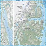
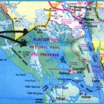
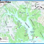
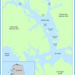
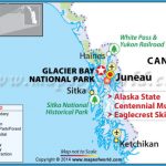
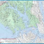
Glacier Bay In little more than 200 years, this area has gone from being a solid wall of ice up to 4,000 feet thick to being a 65-mile bay ecosystem full of wildlife, whales, and slowly returning vegetation. As the ice retreats, it has left behind a series of inlets headed by 11 tidewater glaciers. Among them, the Johns Hopkins, Reid, Lamplugh, Margerie, and Grand Pacific all in the bay’s western arm are regularly approached by cruise ships. Calving activity (large chunks of ice breaking off) from these glaciers is the big draw (Johns Hopkins has so much that ships can seldom approach closer than 2 miles).
Glacier Bay was named a national park in 1925, and today each ship that enters takes aboard a park ranger to provide information about glaciers and wildlife (which includes mountain goats, brown bears, and minke, orca, and humpback whales) and the history of Native peoples and white men in the bay. A strict rationing of permits to the cruise lines means only two ships a day can sail in the park, preventing the place from getting too busy for its own good.
Tracy Arm & Endicott Arm Located about 50 miles due south of Juneau, these long, deep fjords reach back from the Inside Passage into the Coastal Mountain Range, their steep-sided waterways ending in active glaciers the North Sawyer and South Sawyer Glaciers in Tracy Arm and Dawes Glacier in Endicott. All of them calve constantly, filling the waters with miles of brash ice and bergs that ping and thunk off your ship’s hull as you approach the ice faces. The passage through either fjord is incredibly dramatic, the sheer mountain walls rising a mile straight from the water, cut by cascading waterfalls and tree-covered, snow-topped mountain valleys. Wildlife here might include Sitka black-tailed deer, bald eagles, mountain goats, and harbor seals.
Misty Fjords National Monument Covering 2.3 million acres along the Behm Canal, east of Ketchikan, Misty Fjords is actually a flooded cleft between mountains; it’s a stunning landscape of volcanic cliffs, rising up to 3,150 feet and plunging hundreds of feet below the waterline. Peace and serenity are the stock in trade of the place, with its namesake mists imparting a Lord of the Rings kind of atmosphere, abetted by dense hemlock and spruce forests. Its narrow waterway means that only passengers on small ships will see Misty Fjords close up; bigger ships pass the southern tip of the area, and then veer away northwest to dock at Ketchikan, where shore excursions can take you back into the area.
ICY STRAIT POINT
Situated on Chichago Island about 50 miles west of Juneau and 22 miles southeast of Glacier Bay, Icy Strait Point isn’t actually a town, but a self-contained destination owned and managed by Tlingit Indians from the nearby village of Hoonah. Designed specifically for cruise passengers, the site includes a restored 1930s salmon cannery that now houses a museum, a 1930s cannery display, a restaurant, and shops. Principally, though, Icy Strait Point is a destination for adventure-oriented shore excursions, from fishing to cycling to zip-lining. native culture At the Native Heritage Center Theater, near the cannery, a group of Huna Tlingit performs traditional song, dance, and storytelling.
Natural Wonders on the Gulf of Alaska
Hubbard Glacier Lying at the northern end of Yakutat Bay, Hubbard has two claims to fame: It’s the largest tidewater glacier on the North American continent (with Alaska’s widest ice face, at about 6 miles across), and it’s one of the fastest-moving glaciers in Alaska. It’s still an active mother, calving off a substantial amount of ice.
Prince William Sound Located directly south of Anchorage on the bottom side of the Kenai Peninsula, Prince William Sound suffered mightily following the Exxon Valdez oil spill in 1989, but after more than 2 decades of cleanup, the area is well on its way to recovery, with whales, harbor seals, eagles, sea lions, sea otters, puffins, and fish all returned to its waters. It’s one of Alaska’s most appealing wilderness areas, surrounded on three sides by the Chugach Mountains. Scenic College Fjord, in the northern sector of Prince William Sound, is visited on many cruises, mostly for Harvard Glacier, which sits at its head. Perhaps the most spectacular of the Sound’s ice faces, however, is Columbia Glacier, with more than 400 square miles of ice surface and a tidewater frontage of nearly 6 miles. for nature lovers Sightseeing boats with onboard naturalists sail through Icy Strait to Point Adolphus, one of Alaska’s best whale-watching sites. Sightings include humpbacks and orcas, Steller sea lions, and harbor seals. off the beaten path A bus tour to Spasski Creek, about 20 minutes east of Icy Strait, leads to viewing platforms where you may be able to spot bald eagles, land otters, Sitka black-tail deer, and Alaska coastal brown bears a.k.a. grizzlies.

