PISGAH NATIONAL FOREST
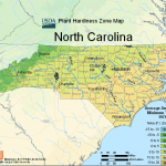
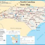
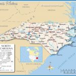
Pisgah National Forest is located on lands near and alongside the Tennessee border, in west-central and northwest North Carolina. It’s a scenic region of high rugged mountains and deep canyon gorges, with a number of rivers and many streams with waterfalls.
There are forests of hardwoods as well as spruce, fir, and pine, including some virgin forestplus dogwood, azalea, and large areas of rhododendron in the Roan Mountain region. Among the wildlife are deer, black bear, bobcat, and fox.
This National Forest has three wilderness areas: the 18,500-acre Shining Rock Wilderness, the 10,970-acre Linville Gorge Wilderness, and the 7,900-acre Middle Prong Wilderness.
Activities: Backpacking and hiking are possible on more than 550 miles of trails, including segments of the Appalachian Trail and the new Mountains-to-Sea Trail (see entry page 225), and
also the 30-mile Art Loeb Trail. Difficulty ranges from easy to quite strenuous.
Many trails are open to horses. Canoeing is available on the French Broad River, and crosscountry skiing is possible during the winter. Rock climbing is an option on some of the mountains. There’s also ample fishing to be found along streams and rivers. Hunting is permitted in season.
Camping Regulations: Camping and campfires are allowed throughout most of the National Forest, except near developed areas or where otherwise prohibited.
A permit is required for camping in the Linville Gorge Wilderness on weekends and holidays only from May 1-October 31. Permits are free and may be obtained either by mail or in person. Maximum stay in the Gorge is two nights.
For Further Information: Pisgah National Forest, 100 Otis Street, P.O. Box 2750, Asheville, NC 28802;(704)257-4200.

