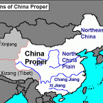
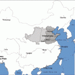
North China consists of treeless steppe and is usually synonymous North China with the Huanghe River catchment area. It comprises the extensive tablelands between the Weihe and the Huanghe, the densely populated, agricultural Great Plain surrounded by Sinian mountains. “Yellow” China is characterised by hillsides with a smooth loess surface and the notorious unpredictability of the river. At the western extreme of this flood plain, the North Chinese Highlands consist of a sequence of narrow, folded mountain chains and follow the typical course of the Chinese strikes – from the south-west to the north-east – gradually sloping down to the northern Carboniferous tables and linking with the dry Gobi desert regions of Taihangshan, Wutaishan and the Jeholloess mountains of Shanxi and the barren Ordos Desert. One interesting feature of the landscape here are the “deflation •basins” of the northern sandy steppes and the deposition since the Ice Age of wind-borne debris in the shape of huge 200m/650ft loess sand dunes.
Human intervention may well have damaged the already meagre vegetation on these steppes, but it has led to the formation of impressive eroded landscapes with gullying on the mountain slopes. The huge amounts of washed outtop soil, which is carried away in particles by the Huanghe and its tributaries, then accumulate in the Great Plain as loess where they form the basis of the intensive farming.
The other important area with outcrops of Palaeozoic bedrock is the Shandong mountain region. The eroded fold complex of the Caledonian and Variscan periods broke into individual massifs, which in the west of the Shandong peninsula now create a landscape of sedimentary table and fault-block mountains. A steep coastal cliff-line is one unusual feature of the granite section to the east.
But the heart of northern China and one of the most intensively farmed and densely populated regions in the world is the Great or “Yellow” Plain. Geologically, this flood plain issimplya river basin that has only recently been wrested from the sea as a “present to China”.
The Great Plain is nothing more than a gently sloping but vast alluvial fan for the Huanghe, which has deposited huge quantities of sediment over thousands of years and has frequently changed its course.
A significant feature of the landscape and something which has influenced the local culture is the struggle of the north Chinese people with the level of the Huanghe which as an embanked river flows above the level of the plain. The threat of flooding preoccupies the local population and the construction of dykes and canals to protect this intensively farmed land involves considerable energy.
The Great Plain is bordered to the west by the Taihangshan, the Tongbaishan and the Dabieshan. Access to the loess highlands and the Ordos Desert is via the tightly constricted Tongguan gorge in the northern slopes of the Quinlinshan.
The Central Chinese Mountain Belt follows the course of a fault-line Central Chinese which is a continuation of the Kunlunshan. It forms a wall of peaks, Mountain Belt some over 4000m/13,000ft high, and shelters the Great Plain from the Tangho basin and the South Chinese highlands to the south. It also forms a well defined barrier between north and south China. The individual elements of the belt merge together to form an east-west mountain belt interrupted by basins and lowland plains (Minshan, Quinlinshan, Tongguan gorge, Dabashan, Wushan, Dabieshan).

