What’s Best: Find an organic snack or offbeat gift in bohemian Fairfax, followed by a hike or bike ride at nearby Deer Park, a redwood-studded gateway to the Mt. Tam watershed.
Parking: From Hwy. 101 take San Anselmo-Sir Francis Drake Blvd. exit and proceed west on Sir Francis Drake about 6 ml, past San Anselmo. At Fairfax, park in long lot between Sir Francis Drake and Broadway. For Deer Park: From Broadway, turn left at stop sign on Bolinas Rd. and go about .5 ml. to veer left on Porteous Ave. Follow Porteous and park at lot in trees just before Deer Park School. Agency: Marin County Department of Parks; Town of Fairfax.
Hike: Bald Hill (3 ml.); Deer Park Ridge Trail loop (1.5 ml.)
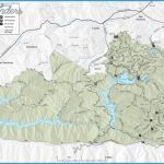
Deer Park is a wooded 54-acre county park, enveloped by the Mount Tam watershed. To Bald Hill for an overview of San Anselmo and the Ross Valley go to your right, through the gate and around the school. Then go left across the field. Take Deer Park Trail, snaking up about 600 feet through mixed broadleaf forest for about .75-mile, coming to Worn Springs Road. Go right, curving along a ridge for another .75-mile. You’ll gain a few hundred feet and break out to a grassy dome. Avoid a left-forking fire road, just to the north of the top. Bald Hill sits at 1,141 feet, an elevation that allows you to see detail of the towns below, and yet feel high above them. And you get an intimate look at Tamalpais, just three miles away as the hawk flies.
For the Deer Park Ridge loop, a woodsy twirl through the creek’s varied flora, go to your right from the picnic-parking area before entering the school grounds. Take the trail from the back of the picnic area up the creek through redwoods. The trail rises up some 400 feet on a .5-mile course. You then descend a bit to Boy Scout Junction where an absurd number of trails join. You want take a left option, down Deer Park Road. Another trail, Six Points Trail, drops down to nearly the same place, and you won’t go wrong if you end up taking it. Once at the creek go left on Deer Park Road.
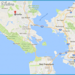
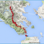
FAIRFAX MAP SAN FRANCISCO Photo Gallery
In 1839 Fairfax was part of a 6,500-acre Mexican land grant. This genteel estate was acquired in 1855 by Lord Charles Snowden Fairfax, a British royal who was lured west by the Gold Rush, leaving a little estate his family owned back east called Virginia. Fairfax, a politico and congenial host, gave the town its resort reputation, which was maintained after his death in 1869. His estate became Pastori’s Hotel & Restaurant, and later the Marin Town & Country Club, which stands today, although in a decrepit state. The town was a movie mill during the early 1900s, when Bronco Billy Anderson cranked out westerns filmed in the area. In 1917, when the Alpine Dam was constructed, Italian workers arrived, giving it the “Little Italy” designation, and spawning bars and restaurants, some of which remain. Fairfax embraced the Hippies in the early 1970s, and, today, its shops and restaurants exude an organic, laid-back atmosphere.
For the Fairfax stroll, cross Broadway to the vintage Tamalpais Theater and turn right. From Broadway, turn left, heading up Bolinas Road for several blocks, ducking in and out of quirky shops. Then go across the street to the Fairfax Pavilion you’ll see it sitting up behind a green space and redwood trees. The Pavilion stands in Fairfax Park, what remains of the original 65-acre plot around which the town was built. From Fairfax Park, head back down Bolinas Road, and then hang a left on Broadway, which is interesting for another block or so.
Fairfax
Bike: To get to San Anselmo and Ross and connect with the Corte Madera Creek bike path, TH28 take Broadway east out of town. When you get to the stop sign at Center Boulevard, veer right on to Landsdale. Landsdale blends into San Anselmo Avenue, which takes you all the way to San Anselmo, on a mellow residential route. At San Anselmo, you can cut right on Laurel and wind your way through residential streets on the west side of the town, or just take San Anselmo Avenue. Turn right on Bolinas Avenue and then left on Shady Lane. Shady Lane brings you into Ross. From Ross you can go right to Phoenix Lake or left behind the post office to the Corte Madera Creek bike path.
Two country-city loops are popular from Fairfax: For a Phoenix Lake loop of about 8 miles, ride up to Deer Park see hiking and take Deer Park Fire Road. After about 1.25 miles, climbing a few hundred feet, you’ll come to Five Corners, where you want to take Shaver Grade down to Phoenix Lake. From the lake, ride down to the parking area and out to Lagunitas Road. Then turn left on Shady Lane, taking the route back to Fairfax described in the paragraph above.
For a shorter loop, about half on dirt, try a 5.5-mile Sky Oaks loop. Head to Deer Park, as described in hiking section, and pedal up the 1.25 miles to Five Corners. At Five Corners, go right on the Concrete Pipe Trail, which contours for about 1.5 miles before popping out on Bolinas Road. You then roll down Bolinas Road back to Fairfax. As a variation on this loop, you can also take Shaver Grade up from Five Corners up about 300 feet over .5-mile and come out on Sky Oaks Road past the ranger station. You then pedal less than a mile back out to Bolinas Road and ride back to Fairfax.

