In our 1972-75 meetings, publications and reports, we focussed on various Dutch engineering studies on the need for full control of rivers from either end and on how public confidence could be restored by full ample flood prevention and protection that was clearly lacking on the upper and tidal Thames at that time. Starting upstream, the provision of new reservoirs and designated flood plains would greatly restore general confidence and also enhance London’s water-supply. Downstream, with the Thames Barrier Act, prompted by the disastrous East Coast floods of 1953, only reaching the Statute blog in 1972, detailed design and construction still lay ahead. Also there had been only limited and delayed response in repairing the damage of repeated heavy bombing of the docks in World War Two and much despair, delay and neglect in the immediate post-war period. The London dockers saw their livelihood disappearing to new facilities downstream to Tilbury (privatised in 2002) and to the highly efficient new ports of Rotterdam and Felixstowe and the widespread mechanisation of cargo-handling through the use of containers. As for the general public, they were largely ignorant of the high pollution in the River and the extent of the deterioration of the shore-line on either side.
Our thoughts triggered an outcry from some river-side residents in Middlesex, Surrey, Berkshire, Buckinghamshire and Oxfordshire accompanied by some expressions of support from Greenwich, Essex and the East End. This, however, was as nothing to the negative but sentimental response country-wide to a suggestion that if the flow of the River could be fully controlled and channelled and London fully protected from the effects of excessive rainfall and freak tidal surges, there would be room for an eight or even ten-lane motorway straight up the river-bed from Dartford to Kew. We were not surprised, concluding that such a response was probably based on deeply-held sentiment and affection for the River Thames. Instead what we all got was continuing floods from time to time upriver and,
formally opened in 1984, a very expensive Thames Barrier, a beautiful piece of design and engineeringthat has provided effective temporary protection but that was built in the wrong place to the wrong out-dated specifications.
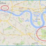
Greenwich University Map Photo Gallery
The Thames Barrier
The snag with the classic repeated Dutch advice to construct an earth barrage well downstream with locks was that, in 1953, the year of the disastrous East Coast floods and heavy loss of life in the Netherlands, the Port of London was still the largest in the world and the fragile UK economy was dependent on the Port of London for a high proportion of its imports and exports and for its valuable entrepot trade. It was considered essential to keep this tidal river fully open to shipping day-in, day-out. This conundrum, confusion and conflict was put by the Government to their designated Chief Scientific Adviser, Professor Sir Hermann Bondi, who quickly declared that the exposure of London to massive damage by a tsunami-like tidal surge was a very real risk and full protection was an urgent priority. He ruled out earthen dams in the outer estuary given that the very large gates and dams necessary would be at the edge of technology and very difficult to assemble and operate in open water. Add to this, very high cost, a long construction period, vulnerability during construction and operation and accompanying delays to shipping. Time was of the essence in minimising risk.
He then looked at four sites within the River, one at Gravesend, two at Dagenham and one at Crayfordness, roughly half-way between Woolwich and Gravesend. Again he concluded that the large drop-gates or swing-gates or retractable barriers proposed were all too clumsy and risky while shipping movements, given the sharp curves in the course of the River, would be severely restricted.
Moving upstream he favoured three sites in the Woolwich reach. The centre site seemed ideal, but would involve dismantling the Tate & Lyle Sugar Refinery, the largest in Western Europe and rebuilding it elsewhere. The Eastern site was considered too close to the Woolwich Free vehicle and passenger ferry and a sharp curve in the River that would present an additional hazard for ships lining themselves up to pass through one of the gates of the Barrier. When the Tate & Lyle claim for compensation was received, it was decided to go for the present Western site, where the land could be purchased quite easily and cheaply. The winning design provided for four main navigation openings, two of them 200-feet wide and the other two 100-feet wide, all with rising sector gates. To allow the free flow of the tide, there are four more openings of 100 feet fitted with falling radial gates. Thus, in principle, four large vessels and two small ones could pass through the Barrier simultaneously at any time when the Barrier was open. When it was fully closed, the Barrier would present a continuous curved face to the incoming tide from one side of the River to the other.
By the time the Barrier was formally opened in 1984 (and by then the flood defences on both sides of the Thames and up the East Coast had been raised at great expense and effort), there was no longer any need for six separate shipping channels and gates. The Surrey Dock system had closed and there were very few vessels still using the other docks upriver of the Barrier and many of their port loading, unloading and warehousing facilities were entering the phase of terminal decay, abandonment, demolition or conversion to other uses.

