Category: Maps
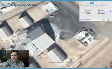
Most visitors to Area 51 come hoping to see UFOs. It’s impossible to discuss UFOs and Area 51 without mentioning the Papoose Lake area, known as “S-4.” S-4/Papoose Lake …
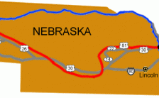
Roads to Kimball County, Kimball Kimball County, Kimball 131 U.S. Strategic Command Center (USSTRATCOM), Bellevue When the President gives the order to launch our nukes, here is where the …
Kimball County, Kimball This small, quaint county on the high plains of western Nebraska was once best known as being the location of the highest point in Nebraska and …
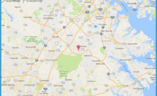
National Security Agency, Fort George Meade If it’s an international telephone call, fax, or e-mail that travels by satellite or microwave link over any part of its journey; it …
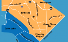
National Geospatial Intelligence Agency, Bethesda “Geospatial intelligence ” is the process of analyzing multiple satellite images to determine what is present, and what is happening, at a given point …
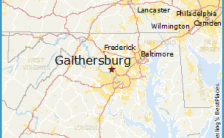
EG&G, Gaithersburg EG&G is one of the Top Secret Government’s favorite companies. It provides high-tech products (like X-ray security devices) and what are nebulously called “asset management services” to …
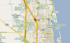
Wackenhut Corporation, Palm Beach Gardens Whether it’s guarding missile silos or Area 51, Wackenhut is one of those companies the Top Secret Government calls when it needs someone else …
Rocky Flats Environmental Test Site, between Golden and Boulder This innocuously-named facility located 21 miles northwest of Denver is a former nuclear weapons fabrication site and a storage facility …