
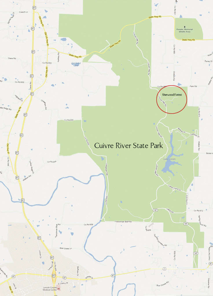
6,250 acres. Located in the rugged Lincoln Hills of northeast Missouri, this rustic park has two wilderness areas: the 1,675-acre Big Sugar Creek Wild Area and the 1,082-acre Northwoods Wild Area, i Big Sugar Creek runs the length of the park. There are some steep hills and bluffs offering nice views, prairie grasslands, oak-hickory forests with dogwood, and an 88-acre lake. Wildlife includes white-tailed deer and wild turkey.
Activities: Hiking and backpacking are possible on 30 miles of trails. Difficulty ranges from easy to moderate. Horseback riding is permitted on some of the trails.
Camping Regulations: Camping is allowed for backpackers only along the trails. It’s necessary to register at the trailhead or park office before starting. Campfires are prohibited, i Campsites must be at least 100 feet from trails, 200 feet from public use areas, and one-quarter mile from entry points. Groups of seven or more must use designated camping areas.
For Further Information: Cuivre River State Park, Route 1, Box 25, Troy, MO 63379; (314)528-7247.


