24335 The Old Road Newhall
Hiking Distance: 5.2-Mile Loop Hiking Time: 2.5 Hours Configuration: Loop Elevation Gain: 1,100 Feet Difficulty: Moderate To Strenuous Exposure: Mostly Exposed Dogs: Allowed
Maps: U.S.G.S. Oat Mountain
The Santa Susana Mountains Separate The San Fernando And Santa Clarita Valleys. Towsley Canyon Sits On The Northern Slope Of The Santa Susana Range, North Of The San Fernando Valley And Just East Of Santa Clarita. This Beautiful Loop Trail Explores Two Canyons In Ed Davis Park, Part Of The Santa Clarita Woodlands Park System. The Undeveloped 6,000-Acre Park Contains Hiking, Biking, And Equestrian Trails.
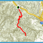
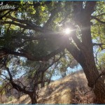
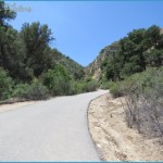
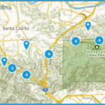
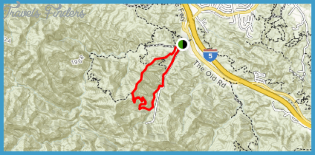
Ed Davis Park Santa Clarita Woodlands Park Map Photo Gallery
The Hike Begins In Towsley Canyon On An Easy, Partially Paved Road That Follows The Canyon Drainage. The Trail Then Climbs Over The Mountain Ridge That Lies Between Towsley Canyon And Wiley Canyon On A Steep, Single-Track Trail. The Scenic Trail Traverses The Mountain Slope And Drops Into Wiley Canyon, Following The Floor Of The Beautiful Stream-Fed Canyon.
En Route, The Hike Cuts Through A Rock-Strewn Crevice With Eroded, Water- Worn Rock Formations Known As The Narrows. Year-Round Towsley Creek Ripples Through The 20-Foot-Wide Gorge Between 200-Foot Vertical Walls Of Sandstone And Conglomerate Rock. The Trail Passes Through A Variety Of Ecosystems, Including Coastal Sage Scrub, Chaparral, Riparian Vegetation, Open Grassland, And Oak And Walnut Woodlands. Along The Ridge Are Expansive Vistas Of The Surrounding Mountains, Canyons, Geological Formations, And The Santa Clarita Valley.
To The Trailhead
From The Golden State Freeway (Interstate 5) In Santa Clarita, Exit On
Calgrove Boulevard. Head South On Calgrove Boulevard, Which Quickly Becomes The Old Road. Follow The Frontage Road 0.3 Miles To The Signed Trailhead Parking Lot On The Right.
The Hike
Walk Past The Trailhead Kiosk And Vehicle Gate. Follow The Old Asphalt Road One Hundred Yards To A Signed Junction. To The Left Is Wiley Canyon The Return Route. Begin The Loop Straight Ahead, Staying In Towsley Canyon. Enter The Mouth Of The Wide Canyon On The Fire Road Along An Easy Uphill Grade. At A Half Mile, Pass The Canyon View Loop On The Left, A Shorter 1.9-Mile Loop. Continue Straight And Pass Through A Vehicle Gate, Where The Dirt Path Begins.
Pass A Crib Dam On The Left As The Canyon Narrows. At One Mile, The Signs Of Civilization Disappear, Hidden By The Surrounding Mountains. Wind Up- Canyon, Passing Seasonal Pools Of Water And Caves In The Eroding Cliffs. Cross The Drainage And Stroll Through The Narrows, A Water-Laced Portal. Walk Through The Boulder-Strewn Gorge Among Weather-Sculpted Rock Formations.
Return To The Open Slopes And Traverse The Canyon Slope. Begin Climbing The North Canyon Wall With The Aid Of Eleven Switchbacks. Throughout The Climb Are Stands Of Walnut Trees, Then Scattered Oaks And Bay Laurel. At 2.3 Miles, Just Before Reaching The 2,450-Foot Summit, A 100-Yard Side Path Veers Left To A Vista Point. The Views Extend Across The Santa Clarita Valley To The Los Padres National Forest. Continue Up, Following The Undulating Ridge With City Vistas To The Left And Mountain Views To The Right. Leave The Ridge And Descend Into Wiley Canyon. Weave Down The Contours Of The Mountain To The Canyon Floor. Follow The Small Waterway Downstream, And Complete The Loop Near The Trailhead On The Right.

