
Urumqi weather station (alt. 913m/2995ft)
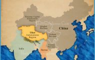
Dry climate The north-west of China consists of huge cold desert and steppe basin landscapes (Tarim Basin, Dsungaria, Mongolian Basin), surrounded by snow-capped mountain ranges. There is a succession of regular changes in altitude starting with the deserts in the lowland basins rising to a steppe and forest zone and leading to the year-round snow and ice in the mountains.
Temperatures drop the higher the altitude but rainfall and humidity increase. An increase in height of 1000m/3250ft results in a temperature drop of about 6°C/10°F. Woodland growth is possible at about 2000m/6500ft above sea-level and at 3700m/12,000ft glaciation can occur. The snow line can vary considerably from peak to peak -3000m/10,000ft in the western Tienshan but 5600m/18,500ft in the Pamirs.
Melt water from the glaciers supplies the oases, often important watering places on the ancient Silk Road, and used in recent irrigation projects. The agriculture of Xinjiang province is not based on rain but on irrigation from the melted snow. The hotterthe sun, the more snow melts. The local farmers are frequently heard to sigh: “We don’t want rain (the clouds will block out the sun). We’ll suffer from drought.”
Xinjiang The weather station at Urumqi, Xinjiang’s capital, lies on the northern edge of the Tienshan Mountains. Rainfall is spread over the whole year. In an average year, total precipitation reaches 273mm/113/iin. with the autumn months being the wettest. Daily and annual temperature fluctuations are considerable. In winter it is bitterly cold with daytime temperatures between November and March remaining below freezing. Sand and snow storms are not unusual. Summers are hot and dry. Relative humidity between May and September falls below 50%. Dsungaria Conditions become hotter and drier as the mountain tops give way to lowland basins. The climate of the Dsungaria, north of Urumqi, ranges from extremely cold steppe conditions in the west to the unmistakable desert climate of the east, on the edge of the Gobi. A desert climate also prevails in the Tarim Basin to the south of Urumqi (Takla Makan), while in the Turpan Depression south of the Tienshan some 154m/500ft below sea level and one of the lowest dry points on the surface of the earth, temperatures can reach 47°C/116°F in summer with only occasional winter frosts. The extremely low levels of humidity in this area explain such phenomena as the Astana cemetery where bodies have mummified.
Map of North-west China Photo Gallery


