
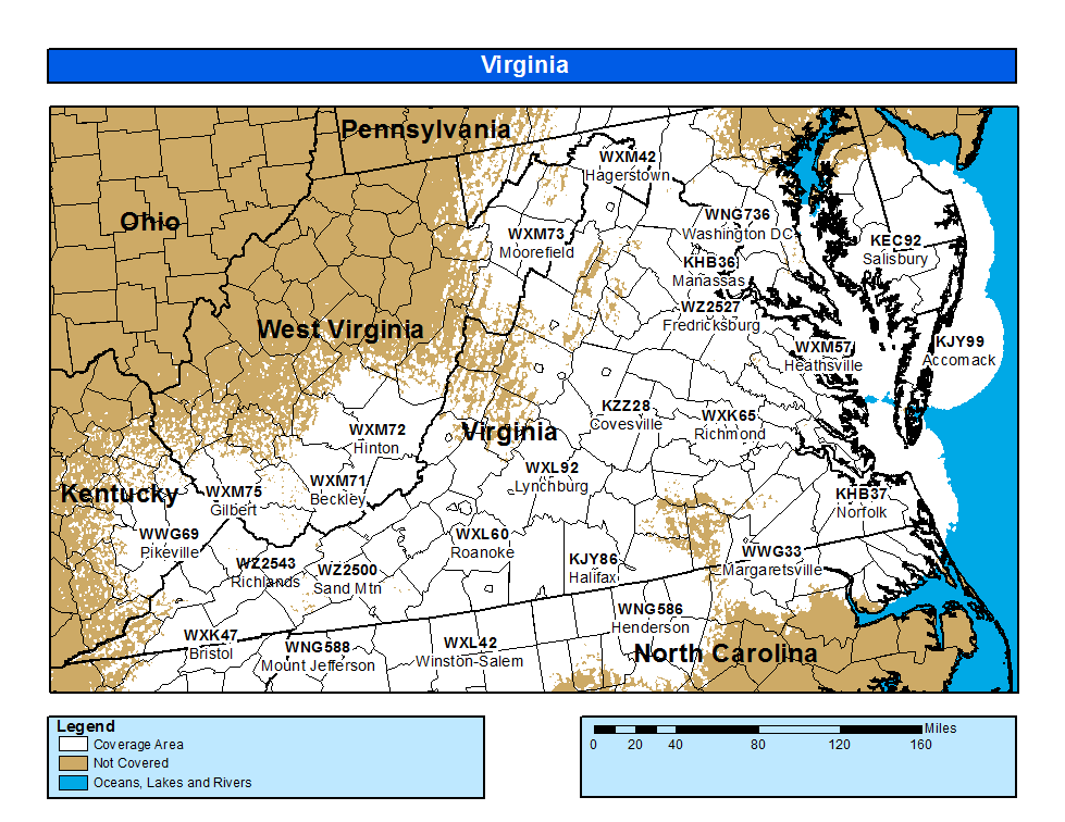
Mount Weather (High Point Special Facility), Berryville
At one time, this was maybe the biggest secret since the Manhattan Project. Built in 1958-60, this facility located over 300 feet inside a mountain was intended to be the ultimate bomb shelter for civilian government leaders (such as the president, vice president, secretary of state, etc.) in the event of nuclear war. It can sustain over 2,000 people for more than 30 days in complete isolation from the outside world; deep within Mount Weather is everything from a hospital to a crematorium to a radio-television studio. On the afternoon of September 11, 2001, Vice President Dick Cheney and several senior Congressional leaders were taken here by helicopter and automobile; this is where Vice President Cheney stayed in the weeks following the attacks. Rumors persist that FEMA maintains a parallel “government in waiting” here should everyone in the presidential line of succession be killed in a surprise attack. In other words, this is arguably the capital of Top Secret America!
Mount Weather is located approximately 75 miles southwest of Washington in the Blue Ridge Mountains, It got its name from the National Weather Bureau, who used the summit to launch weather balloons from 1893 to 1933. President Calvin Coolidge considered building a summer White House on the site. In 1936, Mount Weather was transferred to the Bureau of Mines, who tested new drilling and deep tunneling techniques in the mountain’s solid, unfractured granite that was several hundred feet deep.
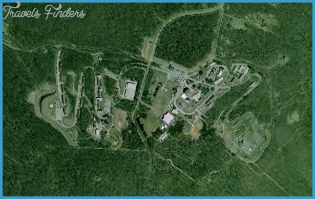
With the rise of the Soviet nuclear ICBM threat in the early 1950s, it became clear that a facility that was both located near Washington and capable of withstanding a nearby nuclear explosion was needed for the nation’s top civilian leaders. Mount Weather was selected as the location for such a facility in 1954, and construction by the U.S. Army Corps of Engineers began soon afterwards. The first underground facilities became operational in 1958, and main construction was completed in 1960. Upgrades and improvements have continued since then, but most recent construction has been aboveground. The aboveground site covers 434 acres and includes conference centers, classrooms and training facilities, dormitories, dining and recreational facilities, and support functions (personnel, data processing, etc.) buildings. Over 900 persons are employed at the aboveground facilities; the exact number of employees working underground is unknown but is believed to be around 50 at most times.
Mount Weather Virginia Map Photo Gallery


Mount Weather has gone to “full operational” status several times, beginning with the 1962 Cuban missile crisis. On September 11, 2001, Vice President Dick Cheney, House Speaker Dennis Hastert, and several Cabinet members were taken to Mount Weather from Washington. Paul Bedard reported in the December 4, 2001 issue of White House Weekly that local residents near Mount Weather reported a motorcade with a police escort entering Mount Weather that afternoon. In the March 1, 2002 issue of the Washington Post, Barton Gellman and Susan Schmidt reported that several government helicopters, escorted by F-16 fighters, had taken several senior government officials, including Vice President Cheney, to an unidentified underground government facility on the afternoon of September 11. From their description of the site, it could have only been Mount Weather.
What’s There: Much of what we know about Mount Weather comes from three sources: an article by Richard Pollack in the March 1976 issue of The Progressive, a report by Ted Gup in the December 9, 1991 issue of Time, and an article by Steve Emerson in the August 7, 1988 U.S. News & World Report. While some details differ, their descriptions of Mount Weather, mainly derived from anonymous former employees, do agree on main points.
The underground facilities at Mount Weather consist of 20 separate buildings, some three stories high (or maybe “deep”), all connected by sidewalks in tunnels. There are two 250,000-gallon water reservoirs, a sewage treatment plant, power generators, air and water purification and recycling equipment, a hospital, a crematorium, communications equipment, computers, cafeterias and dining facilities, meeting areas, a radio/television production studio, and apartments and dormitories. Private apartments are reserved for the president, vice president, Cabinet officers, senior members of Congress, and members of the Supreme Court; others would have to share dormitories or even cots. The door to the underground facilities is ten feet tall, 20 feet wide, and five feet thick; it weighs 34 tons.
Secret Stuff: Is there a “standby government” inside Mount Weather, ready to take over in the event the top civilian leadership is wiped out in a surprise attack? Maybe.
A report in the November 18, 1991, New York Times stated, “Acting outside the Constitution in the early 1980s, a secret federal agency [FEMA] established a line of succession to the presidency to assure continued government in the event of a devastating nuclear attack, current and former United States officials said today. The program was called Continuity of Government.’ In the words of a recent report by the Fund for Constitutional Government, succession or suc-cession-by-designation would be implemented by unknown or perhaps unelected persons who would pick three potential successor presidents in advance of an emergency. These potential successors to the Oval Office may not be elected, and they are not confirmed by Congress.”’ A 1993 CNN report on FEMA identified such prominent Americans as Howard Baker, Jeanne Kirkpatrick, James Schlesinger, and Thomas “Tip” O’Neill as persons who had served as “standby” presidents. In the event of a national emergency wiping out the established presidential line of succession, the “standby” president would be taken to Mount Weather to direct the civilian government. The current status of any such “standby” presidential plans is unknown.
There are reports that similar standby plans exist for Cabinet officers. It is known that employee teams representing the Departments of Agriculture, Commerce, Defense, Health and Human Services, Housing and Urban Development, Interior, Labor, State, Transportation, and Treasury are rotated at regular intervals at Mount Weather; in the event of a national catastrophe, these teams could take over the functions of their departments until normal government operations can resume. It has been reported that each team is headed by a senior executive who would assume leadership of the department should its secretary be killed or incapacitated; this person has Cabinet-level rank and is addressed by subordinates at Mount Weather as “Mr. Secretary.” Unlike regular Cabinet members, these “standby secretaries” can serve for an indefinite term and some have served under both Democratic and Republican administrations.
Getting a Look Inside: There’s no chance of seeing the good stuff underground unless you have one those “above top secret” security clearances. However, many local and regional emergency response personnel without security clearances undergo training each year in the aboveground facilities. Since the September 11 attacks, the security around the perimeter of Mount Weather has been greatly increased; there have been reports that motorists driving in a slow or otherwise “suspicious” manner near the site have been pulled over and questioned by police.
Unusual Fact: The 1962 novel Seven Days in May was about an attempted military coup against the American government. The authors, Fletcher Knebel and Charles Bailey, were Washington journalists who had heard rumors about Mount Weather, and they created a “Mount Thunder” facility that sounded a great deal like Mount Weather. However, few readers at the time realized “Mount Thunder” was based on an actual place; the government did not acknowledge the existence of Mount Weather until 1975, and then only in response to Congressional queries.
Getting There: While “BerryhiII” is the town most associated with Mount Weather, it is actually nearer to the town of Bluemont, near the intersection of Loudoun and Clarke counties. The address of the main entrance is 19844 Blue Ridge Mountain Road, and it can be reached from the intersection of State Routes 50 and 17, or from State Route 7, by following the signs for “Mount Weather EAC” (Emergency Assistance Center).