
Province: Guangdong. Area: 246sq.km/95sq. miles Population: 787,000 (conurbation 9,400,000)
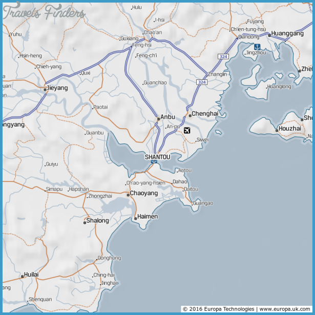
Shantou lies on the South China Sea, in the east ofthe Guangdon province, at 116°38’E and 23°24’N, some 450km/279 miles to the east ofthe provincial capital of Canton.
Shantou Map Photo Gallery


From Canton the city is accessible by plane (1 hour), by bus or by ship.
As with other cities in the Guangdong province the origins of Shantou are uncertain. The only fact which is definitely known is that the city was already an important centre with a lucrative ceramic industry during the Song period (960-1279).
Throughout the centuries the local ceramic craftsmen developed a unique style. The decoration was carried out with particular care, even before the application of separately fired layers of glaze.
In the previous centuries the importance of the city grew with the construction of a port.
At present Shantou is one of China’s special economic areas which in return for the promotion of foreign trade and economic co-operation with other countries has been granted a whole range of privileges.
The Queshi Gongyuan Gardens, situated 1.5km/1 mile to the south of Shantou, are separated from the city by a strait. Many tropical plants surround the two pools.
In the surrounding area are 43 hills with many caves, grottoes, pavilions, arbours and flowerbeds.


