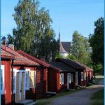
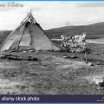
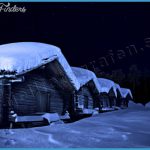
Tarnaby (Tarnaby Turisthotell, 90 Laisalidens Fjallhotell, 46 Sanning-gSrden, 43 b.) lies in a magnificent mountain setting on the southern slopes of the Luxfjall (824 m 2704 ft), 38 km (24 miles) from the Norwegian frontier. Equipped to cater for skiers, the little town has a Lapp Museum and a school for nomad children. 1 2 km Similes) W, on a marked footpath or a motor road, are the Vastensjo and the hill of Gieravardo (fine views). The neighbouring village of Hemavan, which also offers good skiing, has developed into a tourist resort. From here there are panoramic views extending to the hills of Jofjallet and Okstindern, on the Norwegian side of thefrontier. Canoes and gliders can be rented in summer. Fishing is permitted in the lakes above the village. 60 km (38 miles) NE of Tarnaby (road from Sorsele) is the little village of Ammarnas (AmmarnasgSrden, 50 b. and 25 chalets; Jonsstugan, 66 b.), with an old Lapp church; fishing, cross-country skiing, downhill skiing.
Vilhelmina (Wilhelmina Hotell, 81 Vilhelmina Kyrkstad, 138 b.), in the middle of southern Lapland, is the headquarters of the body officially representing the Lapp community and has an interesting Lapp Museum. 95 km (60 miles) NW, by way of Laxbacken (school of agriculture), is the village of Saxnas. It is in a magnificent mountain setting (hills over 1500 m-5000 ft) on the S side of the Kultsjd (alt. 540 m 1772 ft), and has fishing, walking and skiing (Pension SaxnasgSrden, with vacation chalets).
FINNISH LAPLAND
(Finnish Lappi), a forest-covered area of hills and bog (about 94,000 sq. km 36,000 sq. miles), is similar in many respects to Swedish Lapland, but its elevations are lower. Only in the extreme NW, where a finger of territory reaches into the Scandinavian mountain region, is there a mountain of greater height Haltiatunturi (1324 m 4344 ft), the highest peak in Finland. Most of Finnish Lapland is covered with forest; in the S spruce predominates, but beyond Lake Inari (143) there are only pines and birches. At higher altitudes, there are areas of treeless, lichen-covered tundra. The area has been made more easily accessible to visitors by the development of good roads and the provision of hotels and other accommodation. The administrative capital of Finnish Lapland is Rovaniemi (229), a bit S of the Arctic Circle.
The main traffic route from S to N is the Arctic Highway (Road 4 as far as Ivalo). The highway runs from Kempi (1 59) via Rovaniemi (229) and Sodankyla (Kan-takievari Luosto Hotel, 26 Kanta-kievari, 24 b.); wooden church, 1689), to Ivalo, at the S end of Lake Inari (143). From Ivalo the highway continues NE and ends in another 54 km (34 miles) at the Soviet frontier. (It formerly extended to the port of Petsamo on the Arctic Ocean, now the Soviet town of Pechenga.) Road 4 continues to Kaamanen and then runs NW to the Norwegian frontier at Karigasniemi. Another road runs N via Utsjoki and then along the frontier river, the Tenojoki, and over the frontier to the Norwegian port of BerlevSg on the Arctic Ocean.

