WALKING TOUR (3) 4 km round trip: REFUGIO TO THE ERMITA much shorter) trip to this lovely isolated spot avoiding the main road to the lighthouse.
While it is only 4 kilometres round trip it is a steep climb so allow several hours for the return trip including rest along the way and time to enjoy the views and the peace once you get there. Follow as in walking tour (1) and 150 metres past the parish church (Igrexia de Santa Maria de Areas) take the rough and narrow path that veers off to the right up above the road. It is not very obvious so watch out carefully. (If you reach the ruins of the old pump station on the main road you need to retrace your steps 50 metres). After 200 meters you come out on to a wide dirt track. Turn right passing the new water storage tanks (on your left). Continue up the wide track for 600m turning up left at junction. Track up to Monte Facho is on the right after 50m. Continue up for another 300m and take the path up to Monte San Guillermo which passes under the two electricity lines. San Guillermo’s Ermita is the lower (left) of the 3 boulders on the horizon a final 300m up the grassy track.
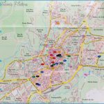
Santiago de Compostela Map Detailed Photo Gallery
WALKING TOUR (4): 2.4 km round trip PRAIA do MAR de FORA The shortest route to this lovely isolated beach (not suitable for swimming – danger ous tidal currents) is as follows: Take the main road out of town, passing the Hotel Finisterre (right) and cross the road at the roundabout to the school oppo site (200 m). Turn up right at the side of the school (sign posted Praia do Mai de Fora). Continue up this road and turn off right after 400 m up a narrow lane After 150 metres turn off left for 150 metres passing new house (Prado do Raid and follow footpath straight to the beach (300m).
If you don’t want to return the same way, you can take one of the several paths at the far end of the beach that passes the main secondary school and sports hall. This brings you back to the San Roque area where you can take the main road back into town (see map of Fisterra).
To return via the lush green valley of Duio (legendary site of the city of Dugium) continue past the church (in the direction of As Escaselas) taking first turn right (500m). Straight over crossroads to the C-550 (400m). Cross over the main road and make your way down towards the sea. You can return either by the path paseo maritimo or make your way onto the sandy beach Praia de Langosteira. Passing the bar/ restaurante Tira do Cordel, up to the cruciero San Roque (1.1 km) and back to the centre of the town and the Albergue (600m). Total round trip 4.6 km.
WALKING TOUR (5): 4.6 km round trip SAN MARTINO de DUIO The shortest route to San Martino (de Abaixo) and the Igrexa de San Martino de Duio is to take the main road out of town and just beyond San Roque veer off left before the petrol station (1.1 km) signposted San Martino. Head up past the Restaurante Ara Solis veering right after 400m. Here the road levels off and continue for another 400m to the delightful parish church of San Martino de Duio. (This pari of Tour (4) is also the start of Stage 4 Fisterra to Muxfa).

