34138 Mulholland Highway
Hiking Distance: 2-Mile Loop Hiking Time: 1 Hour
Configuration: Loop Elevation Gain: 250 Feet Difficulty: Easy
Exposure: Mostly Exposed With A Few Shaded Areas Dogs: Allowed
Maps: U.S.G.S. Triunfo Pass Tom Harrison Maps: Point Mugu State Park Trail Map Tom Harrison Maps: Zuma-Trancas Canyons Trail Map
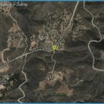
Arroyo Sequit Park Map Photo Gallery
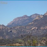
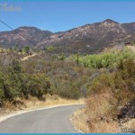
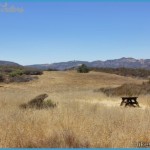
Arroyo Sequit Park Was A Ranch Purchased By The Santa Monica Mountains Conservancy In 1985. Within The 155-Acre Park Are Open Grassland Meadows, Picnic Areas, And A Small Canyon Cut By The East Fork Arroyo Sequit With Oak Groves And A Waterfall. From The Meadows Are Panoramic Views Of The Ocean And Surrounding Mountains. This Easy Loop Hike Visits The Diverse Park Habitats, Crossing The Meadows And Dropping Into The Gorge That Runs Parallel To The East Fork Arroyo Sequit.
To The Trailhead
From Santa Monica, Drive 26.2 Miles Northbound On The Pacific Coast Highway/Highway 1 To Mulholland High Way And Turn Right. (Mulholland Highway Is 14.2 Miles West Of Malibu Canyon Road.) Continue 5.5 Miles Up The Canyon To The Signed Turnoff On The Right At Mailbox 341 38. Turn Right Into The Park Entrance And Park.
From The Pacific Coast Highway/Highway 1 And Las Posas Road In Southeast Oxnard, Drive 10.8 Miles Southbound On The Pch To Mulholland Highway. Turn Left And Drive 5.5 Miles Up The Canyon To The Signed Turnoff On The Right At Mailbox 34138. Turn Right Into The Entrance And Park.
The Hike
Head South On The Park Road Past The Gate, Kiosk, And Old Ranch House. At 0.2 Miles Take The Road To The Left Past A Barn, The Astronomical Observing Site, A Few Coast Live Oaks, And The Picnic Area To The Footpath On The Right. Leave The Service Road On The Nature Trail, Heading South. Skirt The East Edge Of The Meadow, With A Great View Of Boney Mountain To The Northwest, Then Descend Into A Small Canyon. Cross Several Seasonal Tributaries Of The Arroyo Sequit. Head West Along The Southern Wall Of The Gorge, Passing A Waterfall On The Left. Cross A Wooden Footbridge Over The Stream, And Descend To The Canyon Floor. Continue West, Cross The East Fork Arroyo Sequit, And Begin The Ascent Out Of The Canyon To A Junction. Continue On The Right Fork (Straight

