
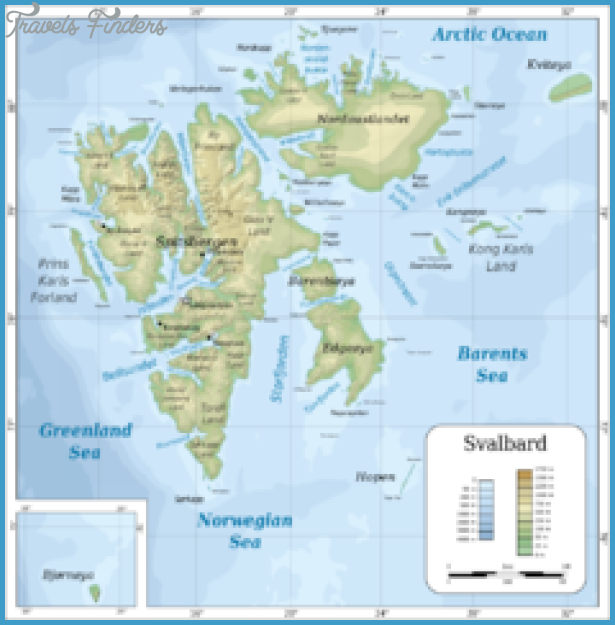
Norway. Administrative district: Svalbard.
Area: 178 sq. km (69 sq. miles). No permanent population.
Bear Island almost inaccessible for tourists lies in the Barents Sea roughly half-way between the mainland of Scandinavia and Spitzbergen. It was discovered in 1596 by the Dutch navigator Willem Barents, who was trying unsuccessfully to find the North-East Passage to China. Since 1925, together with Spitzbergen, it has formed part of the Norwegian administrative district of Svalbard.
This lonely island lies in latitude 75°25′ N, within the area subject to drift ice, and is a
port of call for fishing boats only in the height of summer. Its only activity is a Norwegian weather station with a radio transmitter. The coal-mines formerly, worked here were closed in 1925. Situated at the meeting of a cold current from the NE and the Gulf Stream, Bear Island is almost always shrouded in mist.
On the E coast is the island’s highest hill, Misery-Fjell (Mt Misery, 536 m 1759 ft). To the S is the little port of Sorhamn, hemmed in by sheer rock walls. The steep coastal cliffs are the nesting place of countless Arctic birds, particularly Fugle-fjell (Bird Mountain, 411 m 1348 ft), at the southern tip of the island. The interior of the island is covered with large numbers of small lakes.

