
The Beartooth Pass COLUMBUS TO SILVER GATE
ESTIMATED LENGTH: 131 miles
Estimated time: 4 hours to 2 days (open June-Oct.)
Highlights: Scenic vistas, wildlife viewing, hiking, skiing, Top of the World Store, Yellowstone National Park’s northeast entrance, mining history in Cooke City and Red Lodge
Getting there: The Beartooth All-American Road typically is either the kickoff or exclamation mark for a Yellowstone National Park trip. For the kickoff, exit I-90 at Columbus. For the exclamation mark, folks leave Yellowstone through the northeast entrance after driving through the wildlife-rich Lamar Valley. The closest airports served by major airlines are in Bozeman and Billings, Montana, and Cody, Wyoming. To come through Yellowstone, leave I-90 at Livingston and drive 50 miles south through the aptly named Paradise Valley on US 89 to Yellowstone’s north entrance at Gardiner. From there, it’s 51 memorable miles through the park to Silver Gate. If you do happen to come from Cody, the drive over Chief Joseph Pass through Sunlight Basin on WY 296 to the junction of US 212 is one of the best-kept semisecrets in Greater Yellowstone.
OVERVIEW
It has been several decades since the Beartooth was dubbed America’s most beautiful drive. You’ll quickly see the justification as you follow a twisting ribbon of pavement that has the distinction of being the highest road in the Northern Rockies. The Beartooth All-American Road quickly rises from the vibrant old mining town of Red Lodge to almost 11,000 feet less than 2,000 feet below the summit of nearby Granite Peak, the highest point in Montana. For context, the apex of the breathtaking Going-to-the-Sun Road in Glacier National Park is a paltry 6,646 feet.
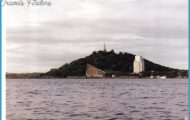
AN AERIAL VIEW OF THE BEARTOOTH HIGHWAY’S SWITCHBACKS SOUTH OF RED LODGE
Once on top, US 212 levels onto a broad alpine-tundra plateau known as the Beartooth Corridor, where the clouds seem close enough to pluck from the sky. Some 20 peaks of more than 12,000 feet are nearby, and the landscape is littered with glacial lakes that shimmer like jewels. Mountain goats and elk are common, and an occasional grizzly bear is spotted in the distance a good reason to bring binoculars or a spotting scope. The elevation is so high that the road is typically only open from the Friday before Memorial Day to the Tuesday after Columbus Day; the remainder of the year it’s covered in snow. Frequent avalanches make winter plowing a proposition too futile or dangerous, and it takes weeks of work by skilled drivers to prepare the highway for its annual opening.
At first glance, you might wonder what would move anyone to undertake such a daunting construction project. The short answer is that the road was seen as a way to boost Red Lodge’s economy in the Great Depression and create access to the potentially lucrative New World Mining District just northeast of Cooke City. The gold mining never panned out, but the road has been a boon to Red Lodge. The town has effectively marketed itself as a destination reminiscent of a younger Park City, Utah, and is a vibrant stopover for Harley riders, skiers, and anyone who appreciates combining a day in the great outdoors with an energetic nightlife.
A portion of this route is in Wyoming. But Montana has never been shy about claiming Yellowstone as its own even though only 3 percent of the park is within the state’s boundaries, so why not all of the Beartooth All-American Highway as well? Furthermore, the only way to reach
Cooke City and Silver Gate in Montana is by passing in and out of Wyoming from either direction. The drive ends amid the spruce and firs of Silver Gate, a mile outside the northeast and least-traveled entrance to Yellowstone.
Even so, there is much more to this drive than the dramatic mountain vistas. The rolling pine, sage, and grass country between Columbus and Red Lodge is beautiful in its own right, and the Beartooths are always there with their spectacular and ever-closer backdrop. The communities along the way Absarokee, Fishtail, Roscoe, and Red Lodge are as inviting as any back-to-back collection of rural towns in Montana.
Beartooth Highway Map Photo Gallery


