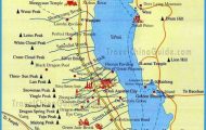
Capital of Hunan Province
Altitude: 44m/145ft. Area: 117sq.km/45sq. miles Population: 859,000 (conurbation 1,070,000)
Changsha lies on the banks of the Xiangjiang, a large tributary of the Changjiang, in a fertile agricultural region in the north-east of Hunan province, at 112°58’E and 28°12’N. The town is served by the Beijing Canton railway and by a small airport.
Changsha can look back on two thousand years of history. In the Spring and Autumn periods and the period of the Warring Kingdoms (771-221 b.c.) it was known as Qinyang because of the amount and quality of handworked and artistic goods it produced (textiles, metallurgy, lacquer-work). It was given its present name in the Qin period (221-206 b.c.), when it was one of the most important towns in China. Under the Song dynasty (960-1279) Changsha became an educational centre. The town walls, parts of which still stand, were built at the beginning ofthe Ming period (1368-1644). In 1664 the Qing rulers elevated it to the status of provincial capital of Hunan. In 1904, under pressure from western powers, the town was opened up to foreigners, and Europeans and Americans subsequently settled here. Mao Zedong (Tse-tung) lived in the town from 1911 to 1923; he studied and taught at the College of Education. In the Sino-Japanese war of 1937-45 a large part of Changsha was destroyed and reconstruction did not commence until afterthefounding ofthe People’s Republic in 1949. Helped by its position on the Xiangjiang, the town developed as a commercial centre; its harbour is now the largest on the river. Today it is also a financial and industrial centre, with light industry predominating.
The early history of the Communist Party Committee of the province is portrayed in the Qingshuitang, which gets its name from a pond which once lay behind the house. The conference rooms and Mao Zedong’s residential quarters can be seen.
Martyr Park (Lieshi Gongyuan) with its memorial pagoda was laid out in 1955 in memory of those who died in the liberation struggle. There is an exhibition hall in the base ofthe 38m/125ft high pagoda.
The Provincial Museum lies in the north-east of the town on the bank of Lake Nianjia. Various archaeological finds are displayed in a total of 10,OOOsq.m/11,000sq.yd of floor space. The exhibits include bronze articles from the Shang era (16th 11th c. b.c.) and painted objects from the period of the Warring Kingdoms (475-221 b.c.). There are also finds from the Mawangdui burial site (see below) dating from the Western Han dynasty (206 b.c. to a.d. 24); these include the mummy of a lady of noble birth (to house which the museum was specially built), which has been painstakingly preserved in its entirety, and the magnificent coffin and grave-goods which accompany it. The corpse is wrapped in about twenty layers of silkand linen sheets. Thetransmigratory banner placed in an inner coffin is in the form of a T-shaped silken picture displaying outstanding artistic skill and radiant colours and is one of the earliest examples of Chinese silk-painting. It portrays the journey of the deceased into the hereafter and also shows mythological creatures.
The Pavilion ofthe Heart of Heaven stands above the south-eastern section of the town walls of Changsha. Its date of origin is uncertain; all that is known isthat it was restored in 1759. Inthe 1950s a public park was laid out around the Pavilion.
The college in the south of the town was burned down in 1938 and faithfully rebuilt after 1949. It was here that Mao Zedong (Tse-tung) studied (1913 18) and taught (1920-21). During that time he organised a student union and evening classes for the workers, as well as founding a Marxist study group. Photos, manuscripts and books in the college document his political career.
The Island of Oranges – so named after the large numbers of orange trees growing here – is a narrow strip of sand 5km/3 miles long in the middle of the Xiangjiang river. The southern end ofthe island has been made into a public park. Here the visitor will find a pretty pavilion and a stone tablet on which is engraved a poem about the town written by Mao Zedong. From the southern end ofthe island there is a particularly good view ofthe river.
Yuelushan Hill, to the west of the Old Town on the west bank of the Xiangjiang, is 297m/975ft high and scenically charming. Historically interesting monuments are scattered over its slopes.
The Yuelu Academy (Yuelu Shuyuan) stands at the eastern foot of the hill; since 1925 it has been the site ofthe University of Hunan.
To airport 16 km
In the evening there is an impressive view to be had from the Pavilion for the Enjoyment of Twilight (Aiwan Ting), which was built in 1792 and restored in 1952. The inscribed pillar (Yuwang Bei) standing on the top of the hill dates from 1212 and describes the struggles of the mythical Emperor Yu against the flooding river.
Lushan-Si Temple, built in 268, is one of the oldest Buddhist sanctuaries in the province. The main doorway and the Cangling Ge pavilion can still be seen.
Close by stands a valuable stone tablet inscribed by the famous cal-ligraphist Li Yong (678-747), which uses more than 1400 characters in describing how the temple was built.


