NOTE: Wyoming Highway 296 is described here from east to west. Instead of taking the Beartooth Highway, you may choose to reach the Northeast Entrance via another beautiful mountain pass, using Wyoming Highway 296, the Chief Joseph Highway. Dead Indian Pass (the former name for this entire route) is nearly 3000 feet (900 m) lower than Beartooth Pass, so this route receives somewhat less snow and is plowed (though not daily) in winter. Why Was This Route Named Dead Indian Pass? The marker at the summit of the Chief Joseph Highway attributes the name Dead Indian Pass to an incident in 1877 involving the Nez Perce tribe and the U.S. Army. Chief Joseph led his people that year from their home in Idaho, across Yellowstone and the Absaroka Range, then down through Clarks Fork Canyon, a route considered impassable by the pursuing army.
One Nez Perce was killed in the area, but about 700 members of the tribe successfully evaded the troops. The group attempted to flee to Canada but was eventually forced to surrender to the army not far short of the Montana-Canada border. Where their route is known, an occasional marker now points out the Nez Perce National Historic Trail. Pilot and Index peaks have long served as landmarks to explorers and visitors. The Nez Perce story is commonly accepted as the source of the old name for this pass, but another conflict occurred near here the following year. Col. Nelson A. Miles surprised a camp of Bannock Indians, killing and capturing many of them. Also, one of the Bannocks was killed and buried here by Crow Indian scouts. 1878 was the last year of troubles between Native Americans and the government in the national park. The Chief Joseph Highway begins at the intersection of Wyoming 296 with Wyoming 120. It’s about 17 miles (27 km) north of Cody or about 32 miles (51 km) south of Belfry, Montana. The sign at the intersection says Sunlight Basin Road. As you drive on Wyoming 120, you can see a distinctive mountain to the east, partly flat-topped, partly craggy, and standing by itself.
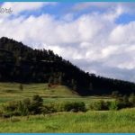
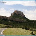
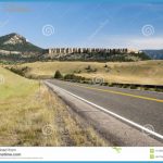
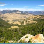
This is Heart Mountain, famous both for the shameful internment of Japanese-Americans at a camp at its base during World War II and also for the Heart Mountain fault or detachment (see the sidebar on 196). Crow people called this mountain Four Tops Father or sometimes Buffalo Heart Mountain. The first 10 miles (16 km) of Wyoming 296 climb from the dry, wide Big Horn Basin to viewpoints dominated on the northeast by a red rock butte and on the south by Pat O’Hara Mountain, named for an old-timer who lived near here. In geologists’ parlance, the red butte is a hogback, a resistant ridge within steeply tilted strata. If you stop on the way up to enjoy the view or the wildflowers, don’t be surprised if you think you hear a trumpet or a saxophone! The Northwest College of Powell, Wyoming, has a jazz camp located on this side of the pass. At the summit, there’s a generous parking area, two wheelchair-accessible restrooms, and a historic marker. Here you have one of the most wonderful panoramas a Rocky Mountain pass can offer, from the Absaroka Range crossing the horizon on the south to the Beartooth Plateau on the north.
Summit View Some of the mountains and valleys from left (south) to right (north) are: Numerous peaks of the Absaroka Range, many above 11,000 feet high (3350 m). The broad flat valley of Sunlight Basin way below. The perfect pyramid of White Mountain. Windy Mountain, farther away and higher, and Steamboat Hill in the foreground. A little to the right and farther away than Steamboat Hill are the two peaks of Sugar Loaf Mountain and a flat-topped hill called Antelope Mesa. Summit View 195 The Clarks Fork River and its canyon are too deeply incised to be seen from here but are marked by the steep rise of the Beartooth Plateau on the far side. The switchbacks west of the summit were paved in the late 1990s. There are several Shoshone National Forest campgrounds, along with ranches and summer homes. After descending from the summit, the road goes around the prow of Steamboat Hill. Then, about 2 miles (3 km) after passing Dead Indian Creek and Campground, a gravel road (Wyoming 7GQ) leads west to mountain-ringed Sunlight Basin.
One-half mile (0.8 km) beyond the gravel road turnoff, park on the right near the highest bridge in Wyoming for a breathtaking look into deep Sunlight Gorge. Sunlight Creek enters the Clarks Fork of the Yellowstone a couple of miles below here. In 1990, 20.5 mi (33 km) of that river received a Wild and Scenic River designation from Congress, preserving it from any development. You can launch kayaks upstream at Crandall Creek Bridge, but only the most experienced Sunlight Basin shelters ranches, summer homes, and a forest service campground. kayakers should consider running the section called The Box, and then only when the water is not too high. In another 14 miles (23 km) or so, Wyoming 296 meets U.S. 212.

