
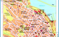
CAROLINA BAY COUNTRY AND THE BLACK RIVER
Period furniture and accessories furnish the upstairs bedroom at Harmony Hall, a late eighteenth-century plantation on the Cape Fear River.
Start out on the bridge over Cape Fear River, east of Tar Heel. Head east on Tarheel Ferry Road. Drive 1 mile, then turn right onto River Road. Drive 4 miles, then turn left onto NC 53. Go a quarter mile, then turn right onto Gum Spring Road. Drive 7 miles, then turn right onto NC 242 south. Drive 9 miles, then turn left onto NC 41. Drive 17 miles, then bear left onto Cannady Road. Drive 2 miles, then continue straight through the intersection onto NC 411. Drive 4 miles, then turn right onto Melvin Road. Drive 1 mile and cross over onto Belvin Maynard Road. Drive 2 miles, then turn right onto Wildcat Road. Drive 1 mile, then turn left onto Ivanhoe Road. Drive 9 miles, then turn right onto Beattys Bridge Road. Cross Black River and after half a mile turn left onto NC 210. Follow it 18 miles to Moores Creek National Battlefield. (78 miles)
Natural beauty and rich biological diversity characterize the route through this little-known region of North Carolina. But you have to work for it. Viewed through a windshield, Carolina bay country, while unquestionably scenic, is not particularly special in the coastal plain. To get the most out of this route, you really need to hike some trails and, ideally, paddle a canoe or kayak.
Our route begins at an increasingly rare site in North Carolina. The steel truss bridge over Cape Fear River is one of only a handful of its type remaining in the state. It is also among the largest. A few miles from the bridge you come to another relic, Harmony Hall, maintained by the Bladen County Historical Society. The exceptional plantation home, built in the late 1760s, has a unique exterior staircase leading to the second floor. On the grounds are other historical buildings of varying ages that have been moved from other locations.
After you drive through the community of White Oak and turn onto Gum Spring Road, look for Live Oak Methodist Church Road on the left. Take a side trip off our main route by driving down this road less than a mile and turning right at the sign for Suggs Millpond. Follow the unpaved road for two miles to the millpond. At first glance, the pond isn’t very exciting. But slip a canoe in it and explore its two arms and you will find yourself in a watery world of stark beauty. Also known as Horseshoe Lake, Suggs Millpond is a Carolina bay that is partially filled with water. Along the shoreline float unique vegetation beds that support large populations of yellow pitcher plants. The pond also contains extensive mats of water lilies and lily pads, and, of course, the requisite cypress trees with swollen buttresses.
Extraterrestrials and Flowing Tea Photo Gallery


