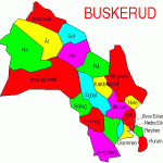
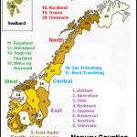
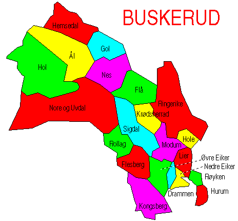
County: Buskerud fylke.
N-3500 Honefoss; tel. (0 67) 2 36 55.
Turistkontoret for Geilo og Hoi,
N-3580 Geilo;tel. (0 67) 8 61 00, ext. 206.
The Hallingdal is a broad valley extending NW from the northern end of Lake Kroderen and traversed by the Hallingdalselv, here a broad and tranquil stream. The river forms a number of lake-like basins, the largest of which is the Brommavatn. The valley is thickly wooded; the hills are bare, with occasional rocky hummocks worn smooth by ice.
In the Hallingdal
At Gulsvik, lying at the N end of Lake Kroderen, National Highway 7 passes through the gateway to the Hallingdal, a road tunnel, with the Hallingdalselv to the right. In another 11 5 km (7i miles) it passes FH church (1858), on the right. Farther along the road are several camp sites and a variety of overnight accommodation (at Stavn, Kolsrud, on an island in the river, Bromma and Rolokken). 33 km (20 miles): Nesbyen (alt. 1 67 m (548 ft); pop. 1500; 0stenfor Turisthotell, 134 SB; SmedsgSrden, 70 Svenkerud Hotel, 62 Thoen Hotel, 48 at Mykingstolen, 22 km (14 miles) away, Ranten Fjellstue, 70 SP; Venehallet Hoyfjellseter, 70 youth hostel; three camp sites, with chalets), situated on a broad detrital cone. To the W is the Hallingdal Folkemuseum, with 14 old buildings, a church of 1862 and a new chapel in the style of the stave churches. Large market in the first week in July. Excursions to various beautifully situated summer grazing stations (overnight accommodation; toll roads). From here it is
21 km (13 miles) to the important road junction of Gol (alt. 207 m (679 ft); pop. 1800; Pers Hotel, 236 SB; EidsgSrd Turisthotell and Motel, 60 Granheim Feriesenter, 96 SP; Glomsrud Hpy-fjellseter, 25 km (1 5 miles) away, 70 Solstad Hotell, 2 km (1i miles) away, 48 Storefjell H oyfjeI Ishote11, 20 km (12i miles) away, 250 SB; four camp sites, with chalets). Chair-lift (length 1600 m (5250 ft), height difference 450 m (147-5 ft); fine views from top). 1 5 km (1 mile) beyond Gol Road 49 goes off on the right to Fagernes (52 km 32 miles). 25 km (15 miles): Sanderstolen Hoyfjellshotell (170 SB). At Leira Road 49 joins E68 (Oslo-Honefoss-Fagernes).
2 km (H miles) beyond Gol at the Heslabru, which spans the Hemsila, a tributary of the Hallingdalselv (beautiful waterfall), Road 52 branches off on the right and runs NW up the Hemsedal. After passing the new church of Gol it crosses the Robru (7 km 4 miles). The valley now becomes somewhat more open. At Granheim (alt. 546 m 1791 ft), 7 km (44-miles) farther on, is the 550 m (600 yds) long Eikre dam (1959), from which water is conveyed in a tunnel
15 km (10 miles) long to the power station at Gol. On the way to Ulsak (alt 609 m (1998 ft); camp site) the road passes on the left the Helmens Bru hydroelectric station, which is supplied with water by a tunnel 14 km (8 miles) long with a fall of 540 m (1770 ft). View of the Veslehorn (1300 m 4265 ft), on the E side of which is a waterfall 140 m (460 ft) high, the Hydnefoss, and beyond it the Storehorn (1478 m 4849 ft). From UlsSk a mountain road (toll) goes off on the right to Lykkja, passing the Skogshorn (1728 m 5670 ft), which can be climbed in 2-3 hours; from
Lykkja it is possible either to continue to Ron (48 km 30 miles) and Fagernes or to turn S to Fjellheim and Gol. From Uls£k it is another 3 km (2 miles) on Road 52 to the vacation and winter sports resort of Hemsedal (alt. 609 m (1998ft); Skogstad Hotel, 150
SP; Hemsedal Turisthotell, 85 Fossheim Pensjon, 102 four camp sites, with chalets). Chairlift and several ski-lifts. The road continues to Borlaug, where it joins E68.
From Gol the route through the Hallingdal continues SW of Highway 7, which for much of the way runs close to the tumultuous Hallingdalselv (numerous waterfalls). In 13 km (8 miles) it comes to Torpo (alt. 327 m 1073 ft), with the nave of a 13th c. stave church (fine carving and ceiling paintings). 8 km (5 miles) farther on, at Gullhagen, a road goes off on the right and runs past the new Alpine skiing resort of Svarteberg (two ski-lifts) to Leveld (chapel). From here it is possible to continue on the Fanitullvei to Hemsedal or to the Bergsjo Hoyfjells-hotell (1084 m (3557 ft); 60 b.), to the NW, or alternatively to return to the main road by way of Hovet. 3 km (2 miles) beyond Gullhagen is Al (alt. 437 m (1434 ft); pop. 1500; Sundre Hotel, 48 Al Gjestgiveri, 23 three camp sites, with chalets), with a large 18th c. church. Beyond Al the Hallingdalselv opens out into the Strandefjord: the road continues along its N side. At Kleivi, at the far end of the fjord, is the Hoi 3 power station, and on the other side of the river the Usta station. The road continues to Hoi (church of 1924), where Road 288 (the Aurlandsvei) goes off on the right to the Aurlandsfjord (97 km 60 miles). This very attractive tourist road, with numerous tunnels, was opened only in 1974.
Beyond Hoi, Highway 7 ascends the wooded Ustadal, through which the Ustaelv flows in a deep gorge to the left of the road, and comes in 11 km (7 miles) to Geilo (alt. 795 m (2608 ft); pop. 2000; Highland Hotel, 174 SB; Bardola Hoyfjellshotell, 180 SP, SB; Geilo Hotell, 145 Holms Hotell, 120 b„ SB; Vestlia HoyfjellshotellGeilo Sporthotell, 142 SB; Ustedalen Hoyfjellshotell, 100 SB; youth hostel; four camp sites, with chalets), a popular holiday resort with excellent Alpine skiing, several ski-lifts and a chair-lift to the Geilohoyda (1056 m (3465 ft); restaurant). To the S of the town the Numedal road from Kongsberg joins Highway 7.
3-5 km (2 miles) beyond Geilo, at Fekjo (to the ieft of the road), are 17 burial mounds of the 9th and 10th c. discovered in 1923. The road then climbs steeply for 8 km (5 miles) to Ustaoset (alt. 991 m (3251 ft); Hoyfjellshotell, 145 SB; Fjellstue and Motell, 50 Solheim Fjellstue, 45 camp site, with chalets), on the N side of the Ustevann. The dominant feature of the landscape is the Hallingskarv (1933 m (6342 ft): climbed in 6-8 hours), a partly snow-covered mountain to the N. To the S is the Ustetind (1376 m (4515 ft): 3-4 hours). Highway 7 continues to the Eidfjord.

