
There’s even a symphony for the olfactory folks to savor in the wafting aroma of feedlots breaking through the amber wheat fields. (just west of Washington, KS on Kansas Highway 36E, looking north through driver’s side window, 15:40PDT, SX700 1/1000 f5 ISO100)
Marysville and her approach bridge over the Big Blue (actually sort of brown when we were there) River and the wondrous sound of more than a half-dozen active sets of rail for the local Union Pacific crew exchange area – but more on that later. (west end of Marysville, KS on Kansas Highway 36E, June 18, 2016, 16:02PDT, SX700 1/1000s f5.6 ISO250 looking east through front windscreen)
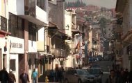
Just off the main drag, small town life and the past leap to the forefront with brick and cobble stone streets still present. (Marysville, KS, 16:05PDT, SX700 1/1000s f4 ISO100 looking east out driver’s side open window with car now aimed south hooking around the block.)
