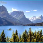
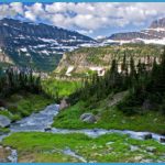
Even in the heart of summer, watching silver-tipped clouds race just overhead is enough to make a knowing Montanan shiver. The Big Hole Valley is known for extreme cold cold air, cold water, and bone-chilling history. The air in this high mountain valley in the far southwest corner of the state is so crisp and dry that hay is safely stored in the open, stacked by the stately wood-plank beaverslide haystackers that look like giant catapults from medieval days. The water is so brisk that the sparkling Big Hole River is home to a native population of fluvial Arctic grayling, a revered native fish making its last river stand in the Lower 48 here. And speaking of last stands: you can’t help but feel a bit melancholy upon visiting the haunting Big Hole National Battlefield, where the peace-loving Nez Perce’s gallant pursuit of freedom in 1877 suffered an irreparable blow along the North Fork of the Big Hole River.
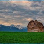
CATTLE, HAYSTACKERS, AND MOUNTAINOUS BACKDROPS ARE FIXTURES ON THE PIONEER MOUNTAINS SCENIC BYWAY
This is the Big Hole country, a remote and rugged region spreading out below the backbone of the Rocky Mountains. The Lewis and Clark expedition explored this country in 1805 on its journey west and then years later returned over Gibbons Pass west of present-day Wisdom. In fact, William Clark himself came up with the name Wisdom, a nod to President Thomas Jefferson’s foresight. The river’s name was changed to the Big Hole before the 19th century was out, but Wisdom lives on in a tiny community that looks much like a setting for a shoot-’em-up western.
The symbol of the Land of 10,000 Haystacks is the beaverslide, invented and patented in the valley in 1910 and a staple today even as other regions evolve to more modern technology and smaller stacks. These giant wooden contraptions are responsible for the prolific large stacks of hay throughout the valley. Though many haystackers in the Big Hole are now made of metal, the technique is the same: Horses or tractors use belts to ease the hay up the slide and then flip it over into a roll the size of a small barn. For a time it appeared the beaverslide would go the way of the passenger pigeon, but it’s undergoing a revival as high fuel costs have ranchers looking for more economical ways to preserve a lifestyle.
HITTING THE ROAD
We suggest starting and finishing the Land of 10,000 Haystacks/Pioneer Mountains Scenic Byway loop in Dillon (pop. 4,219), where you’ll find all the necessary services. Dillon is a longtime ranching, logging, and mining town evolving into a place where aesthetics, wildlife, quiet recreation, and intrinsic values are of equal or greater importance to earlier activities. The upgrade of its four-year school, Montana Western, from a teachers’ college to a full-fledged university, along with a gradual influx of newcomers, is changing the culture. That said, the town is in no immediate danger of becoming a Bozeman, Missoula, or Whitefish, even though the environs are just as beautiful, rugged, and appealing.
Dillon has several worthwhile stops. The Beaverhead County Museum (406-683-5027, Mon.-Fri.), in a log building along the railroad downtown, offers an array of pioneer artifacts, including the city’s first flush outhouse toilet, a homesteaders’ cabin, mammoth bones, and plenty of old mining and logging equipment. A mile northeast of town on MT 41, Clark’s Lookout State Park (406-8343413) is on a bluff overlooking the Beaverhead River where Captain William Clark, separated from a fretting Meriwether Lewis and his party, climbed on August 13, 1805, to survey the valley. The pair reconnected three days later at a site now submerged in Clark Canyon Reservoir south of Dillon.
To get to the loop, leave I-15 3 miles south of Dillon at Exit 59 and head west on MT 278. After traveling through sage and grass ranchlands over modest Badger Pass, with the East and West Pioneers rising dramatically to the north, you’ll drop into the valley of Grasshopper Creek. Once over the pass, look for signs pointing the way to Bannack State Park (406-834-3413), site of the best-preserved ghost town in Montana. Turn left on Road 5, drive 3 gravel miles, and look for the turn along the creek bottom For a few years in the mid-1860s, Bannack was the first territorial capital of Montana, thanks to a huge gold discovery there. One reason the buildings are so well-preserved is that gold was mined there as late as the 1950s. When the last miners left, the state designated Bannack a state park. More than 60 structures remain, most open to public exploration.
Back on MT 287, you’ll soon arrive at the junction where the actual loop begins. The right fork continues up the Grasshopper Valley toward Polaris and Wise River; we suggest continuing on over Big Hole Pass into the Big Hole Valley. As you cross the Big Hole Divide, sweeping views of the upper valley likely will provide the first sighting of the beaverslides and giant haystacks. In the distance are the dramatic Beaverhead Mountains.
Appearing like a dot amid the wide-open spaces is Jackson (pop. 134), built around its namesake hot springs. Soak in the enclosed and family-friendly Jackson Hot Springs (406-834-3151) mineral pool, which is a bit rustic, yet clean and chemical-free. This is a Montana landmark with a welcoming bar, restaurant and lobby area for lounging. At the north end of the short main street, in an old white church, the Buffalo Gal Hat Company & Gallery (406-834-3236) is ready to outfit you with hats, gloves, photos, gift items, or just good conversation.
For the next 18 miles, you’ll see enough Angus cattle to feed a small nation before you reach
Wisdom (pop. 98). Turn left on MT 43 and head another 10 miles to the Big Hole National Battlefield (406-689-3155), one of the most poignant sites on the 1,170-mile Nee-Me-Poo Trail. It was here, on an eerily quiet August night in 1877, that the fate of more than 750 Nez Perce led by Chief Joseph was sealed (see sidebar). Be sure to ask to see the film when you go to the visitor center, which underwent repairs and restoration in 2011. If you’re lucky, you might see a moose browsing on willows in the deep marshy river bottom below.
The visitor center remains open in winter, but you probably won’t be able to access the battlefield trails unless you have snowshoes or skis. If you do have them, after exploring the historic site be sure to also continue west on MT 43 toward Lost Trail Pass (406-821-0025) for some of the best-groomed Nordic skiing in Montana at Chief Joseph Cross-Country Ski Trails not to mention solid downhill skiing and a hot springs swimming pool at the pass to soothe tired muscles.

