Altitude: 15m/49ft. Area: 867sq.km/335sq. miles Population: 2,130,000 (conurbation 3,740,000)
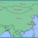
Nanjing lies on the Changjiang, in the west of the province of Jiangsu, at 118°42’E and 32°07’N. In the east of the city rises the Purple Mountain (Zijinshan) and in the west the Stone City (Shitou Cheng), which together are likened to a rolled-up dragon or tiger.
Nanjing Map Photo Gallery
The city is connected to Beijing, Shanghai, Tianjin and other major Chinese cities by rail, road, air and river-boat. There are regular charter flights to Hong Kong.
Nanjing is the political, economic – with heavy industry of prime importance-and cultural centre ofthe province of Jiangsu. For centuries the city has been famous for its velvets, silks and brocades. Important agricultural products from the surrounding area include rice, cereals, fruit, vegetables and tea. Nanjing University is famous both in China and abroad.
Nanjing owes its present appearance to the first emperor of the Ming dynasty (1368-1644), who had a high “perimeter wall” and many buildings erected. The building work, which began in 1369 and lasted 18 years, turned Nanjing into an enormous city stretching over more than 33km/ 21 miles. The city wall, which is built out of large bricks, rested on granite foundations and contained numerous watch-towers which were connected by a wide stone-paved passageway.
The area around Nanjing was already settled over 5000 years ago. In 495 b.c. at the time ofthe Warring Kingdoms, an armaments foundry was established here, around which a town gradually developed, going on to become the capital ofthe Wu Empire (220-280). In later centuries there was a succession of dynasties: the Eastern Jin, Song, Qi, Liang, Chen and first Ming (1368: the city was called Yingtian at this time). The leaders of the Taiping rebellion of 1853 came from here, then in 1911 the Chinese republic followed and in 1928 the Guomindang, following the example of the Wu, chose Nanjing as their seat of government.
Over the centuries many families from the north, fleeing from unknown invaders, took refuge in Nanjing. Thetown started to acquire real economic and cultural importance and even when the capital was moved to Beijing in 1421, the town, under its present name of Nanjing (southern capital), held on to its economic (shipbuilding) and cultural hegemony, to which the presence ofthe imperial academy made a not inconsiderable contribution. In 1842 Nanjing saw the signing of the first treaty which laid down far-reaching concessions to the colonial powers. After the crushing of the Taiping uprising in 1864 Nanjing was almost completely destroyed and its reconstruction took many years. In 1937 the city fell into the hands of the victorious Japanese who carried out a massacre against its civilians. In 1949 the People’s Liberation Army conquered Nanjing, which was declared capital ofthe province of Jiangsu three years later.
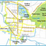
Built in 1382, the Drum Tower stands in the city centre on the west side of the People’s Square and is today used for exhibitions of paintings and calligraphy, etc. In the Ming period (1368-1644) it constituted the centre of the city, an honour which is now held by Xinjiekou, about 2km/1 mile to the south.
Close to the Drum Tower stands the Bell Pavilion, which was built in the 19th c. to take the place of a tower which had collapsed in the 17th c. It contains a 14th c. bell weighing 23 tonnes.
The Palace ofthe Heavenly King in the city centre dates from the time when Palace of the Nanjing was the capital of the “heavenly kingdom” of the leaders of the Heavenly King Taiping Uprising. Only a small part ofthe original extensive building has (Tianwang Fu) been preserved.
Sun-Yat-sen Mausoleum
The 395ha/lV2sq. mile Black Dragon Lake in the north ofthe city occupies a large area of the park of the same name. It contains five small islands interconnected by bridges and causeways: Cherry Tree Island (Yingzhou), Beam Island (Liangzhou), Round Island (Huanzhou), Water Chestnut Island (Lingzhou) and Emerald Island (Cuizhou). The lake gained its name back at the beginning ofthe 5th c. aftera blackanimal was seen there-supposedly a dragon, but in reality probably a crocodile.
Under the Ming dynasty (1368-1644) Beam Island was used to house the largest state archive in China. It consisted of two parts, the register of inhabitants (Huang Ce) and the register of land tenure (Yuling Ce). The archive was manned by over 80 clerks but after a census, which was carried out every ten years, an additional thousand workers would be employed on a temporary basis.
Today Beam Island is the lake’s main tourist attraction because it boasts many architectural monuments set in picturesque surroundings. These include the Temple of the Spirits of the Lake (Husheng Miao), the Lotus Blossom Pavilion (Shanghe Ting) and the Tower with the Beautiful View (Lansheng Lou).
Today it is still possible to see certain sections of the city wall which was built at the beginning of the Ming dynasty (1368-1644) and which at one time encircled the whole ofthe old centre of Nanjing. This defensive wall was originally 33km/21 miles long, 12m/39ft high and 8m/26ft thick.
Garden with the Fine View (Zhanyuan)
The best preserved sections of the wall are to be found on either side of Sun-Yat-sen Gate in the east ofthe city, built in 1927.
Nanjing Museum is housed near Zongshan Gate in a wooden building based on the architectural style ofthe Liao period (907-1125). The history of the province of Jiangsu is dealt with and exhibits include ceramics and bronzes.
Not far from the museum, in Noongate Park (Wumen Gongyuan), lie the ruins of theformer Imperial Palace, which was built between 1368 and 1379 forthefirst Ming Emperor Zhu Yuanzhang and later served as the model for the imperial palace in Peking. After the capital was transferred to that city in 1421 the palace in Nanjing fell into disuse and was partially destroyed. Only the Noon Gate (Wumen) and the Five Dragon Bridge are leftto testify to the building’s former greatness.
On the eastern edge of the city, at the foot of the Purple Mountain (Zijinshan), lies the Tombofthe first Ming Emperor Zhu Yuanzhang (1328-1398). It was built between 1381 and 1383 and is the largest ofthe 14 Ming tombs (the other thirteen are to be found on the northern edge of Peking). Over the years the mausoleum has suffered considerable damage.
The burial site is on a massive scale, comprising not only the actual tomb chamber, but also, besides several memorial buildings, a broad “path of the soul”, lined with stone sculptures arranged in pairs, representing animals, mythological creatures, dignitaries, etc.
To the east of the Ming tomb the visitor will come to the memorial to Sun-Yat-sen (see Famous People), occupying 8ha/20 acres on the top of a hill. The body ofthe famous statesman, who died on March 12th 1925, was transferred to Nanjing from the Peking Temple ofthe Azure Blue Clouds in 1929 and interred here. The politician’s famous aphorism “The world belongs to everyone” (Tianxia Wei Gong) is inscribed over the main doorway. The main building contains the memorial hall built of white granite and the burial chamber. In the middle ofthe memorial hall there is a statue of Sun-Yat-sen in a seated position. His “general programmeforthe reconstruction of the nation” is engraved on black marble on the walls.
The Temple ofthe Valley of Spirits is situated to the east ofthe Mausoleum of Sun-Yat-sen. Founded in the 6th c. it originally stood on the site now occupied by the Tomb of the first Ming Emperor. When the latter sought a site for his mausoleum, the temple was moved to its present position in 1381. It owes its fame primarily to the main hall (Wuliang Dian), still well preserved, which is remarkable for having no beams. Only bricks were used in the temple’s construction and these, skilfully interlocked, support the ceramic tiled roof with its double ledge. The central and largest of the five arches which divide up the pavilion is 14m/46ft high and 11 m/36ft wide.
The observatory, which is situated on a western summit of the Purple Mountain, was founded in 1934 and is the largest astronomical research institute in China. It possesses many modern astronomical instruments, but also some from previous centuries, including a bronze armillary sphere from the Ming era (1368-1644).
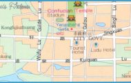
The Confucius Temple consists of several buildings and is situated in a quarter of the city which frequently plays host to cultural events and other leisure activities. It was built in 1869 on top of the remains of an earlier existing building which was burned down in the early 12th c.
The Garden with the Fine View, which lies to the west of the Confucius Temple, was the private garden of General Xu Da at the beginning of the Ming dynasty (1368-1644). It was given its present name by Emperor Qianlong (reigned 1736-96), who was responsible for the two ideograms on the plaque over the entrance.
This building originally formed part of a palace belonging to the first ruler ofthe Ming dynasty, Zhu Yuanzhang (1328-98). In 1853, when the Heavenly Taiping Kingdom chose Nanjing to be its capital, one of its most important military leaders, Yang Xiuqing, fesided here. In 1958 the Museum of the Taiping Uprising (Taiping Tianguo Lishi Bowuguan) was housed in the building.
The Flower Rain Terrace lies on a hill in the south ofthe city. According to legend it was here that a Buddhist monk preached so movingly that a rain of flowers from heaven fell down – hence the name.
A memorial recalls the victims who were executed on the orders of Chiang Kaishek in 1927.
Mochouhu Lake extends over 47ha/116 acres in the west of the city. It derives its name from a beautiful woman who lived in this area in the 5th c. and whose statue can be seen to the west ofthe Tulip Pavilion (YujinTang). The present buildings date from the 1950s.
Close by stands the Tower of the Victorious Game of Chess, dating from 1871. Its name commemorates a game of chess which the Ming Emperor Taizu played against General Xu Da. On losing the match the emperor presented his victor with the lake and its monuments.
In the west ofthe city, along the bank ofthe Qinhuai River, stands a 3000m/
2 mile long stone wall (averaging between 0.3 and 0.7m/1 and 2’Aft in height; 17m/56ft at its highest point), the only remaining evidence of the original fortifications built by Sun Quan, King of Wu, in the 3rd c. which also included a fortress and a defensive ring.
The bridge over the Changjiang in the north-west of Nanjing was built between 1960 and 1968 and consists of two levels: a 6772m/4% mile long railway bridge and a 4589m/1’/2 mile long road bridge. The Chinese are particularly proud of this piece of construction because it was designed and built without any foreign aid.
About 12km/7’/2 miles north ofthe city rises the Swallow Stone of Yanshan Mountain on the Changjiang. On top of the rock, which resembles a swallow in flight, there is a pavilion with a stone stele with calligraphy by the Qianlong Emperor (reigned 1735-96).
The Temple of the Dwelling of the Evening Clouds, situated 22km/13’/2 miles north-east of the city on the 440m/1444ft summit of Quixiashan, was originally built in 483 by the hermit monk Ming Sengshao, but was destroyed by a fire in 1855. Most ofthe present buildings date from 1908; they contain many sculptures from the Tang and Song periods (618-1279). The 15m/50ft high Sarira Pagoda (Sheli Ta) is thought to date back to 601.
Only a short distance away stands the Amatayus Hall, built by the son of Ming Sengshao in 484 in order to pay homage to the 10m/32ft high statue ofthe Buddha of Eternal Life (Wuliangshou Fo). The Buddha is framed by two Bodhisattva figures.

