Pine Bluff Chemical Activity, Pine Bluff
The lush, green countryside northwest of Pine Bluff is home to about 12% of America’s stockpile of chemical weapons, including blister and nerve gases. But it’s also where the Army produces and maintains protective clothing and protective masks for soldiers.
Pine Bluff Army Arsenal was established in 1941 and from its beginning was a storage and production facility for chemical weapons. Storage of biological weapons was added in 1953, although this was discontinued in 1969. The arsenal is currently used to manufacture and store incendiary and non-lethal riot control weapons (such as tear gas) in addition to chemical weapons. The chemical weapons are stored in the Pine Bluff Chemical Activity section located on 430 acres in the northwest section of the almost 15,000-acre arsenal.
What’s There: Over 3,500 tons of mustard gas in one-ton containers, over 100,000 small rockets with nerve gas, over 200 rocket warheads with nerve gas, and over 9,000 mines with nerve gas. Chemical/biological suits, masks, and filters are also stored here.
Key Facilities: Several hundred “igloo” structures designed to contain the gases in case of a leak dot this facility. In addition, a chemical weapons disposal site is currently under construction.
Getting a Look Inside: No public tours are offered, but several buildings can be seen from Highway 365, which parallels Pine Bluff Chemical Activity for several miles.
Unusual Fact: Pine Bluff was the birthplace of former heavyweight champion Sonny Liston.
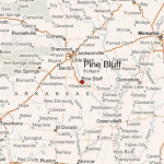
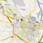
Getting There: Pine Bluff Chemical Activity is located approximately eight miles northwest on Highway 365, or about 35 miles south of Little Rock.
Roads to Pine Bluff Chemical Activity, Pine Bluff
Pine Bluff Chemical Activity, Pine Bluff.

