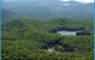
What’s Best: A wildlife marsh spreading beneath a 300-foot-high oak ridge creates a gathering spot for an assortment of birds and woodland critters.
Parking: From Hwy. 101 in north Novato, take the San Marin Dr-Atherton Ave. exit. From Atherton Ave, make an immediate left on Binford Rd, a frontage road. Park at MCOSD gate about .25 ml. from Atherton. Agency: Marin County Open Space District Until the late 1800s, the trail along Rush Creek marked the boundary between two large Mexican land grants: Rancho Olompali to the north and Rancho Novato to the south. Rush Creek, which flows just north of today’s trail through marshlands, was used to barge supplies about 5 miles downstream to the Petaluma River, and then onto the San Pablo Bay. The Marin County Open Space District established the preserve in 1986. The preserve, in effect, is made larger by some 200 adjacent acres to the north, which are part of the Rush Creek Marsh Wildlife Area.
For the Rush Creek loop, start down Pinheiro Fire Road, named after an early settler. The reeds and marsh grasses of meandering Rush Creek will be on your left, and the oak and laurel ridge rises to your right. Marin’s grandest blue oaks live here. Numerous species of birds flit about in this transition habitat. After about 1.25-mile you reach a fork. Take the levee trail to the left onto the marsh, beginning a loop around the lagoon. Across the levee, go right on the Rush Creek Fire Road, heading now on the opposite side of the lagoon, for about .5-mile, where you rejoin the Pinheiro Road.
The Pinheiro Ridge loop provides a look at the oak hills of the preserve as well as the marsh loop portion of Rush Creek. You need to use a different trailhead. Parking: Continue east on Atherton Avenue from Highway 101 for about a mile, and turn left on Saddle Wood Drive, which is just before Bugeia Lane. From Saddle Wood, look for the MCOSD gate on your left near Trailview Court. You’ll see the Pinheiro Ridge Fire Road heading up the ridge toward a large water tank. You hike up about 200 feet into oak grasslands and then drop down to the lagoon that is described above.
If gold can be said to have built San Francisco, then the rainwater that fell upon Tamalpais formed Marin. Meaning “Bay Mountain” in the language of the Coast Miwok, Tamalpais is steeply fissured. From its peak, steep ridges radiate in all directions, covered by a thicket of greenery that is nourished by subtropical amounts of rain 60- to 90-inches yearly is not uncommon. California’s first publicly owned water district, the Marin Municipal Water District, was formed here in 1912, insuring equal water for all and effectively preserving the entire watershed of Tamalpais from any activity that would spoil the supply.
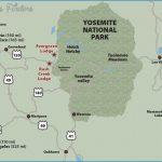
RUSH CREEK MAP SAN FRANCISCO Photo Gallery
Tamalpais has always drawn people who love to hike, and the mountain stands as testament to how this attraction can be held as most valuable in the sensibilities of a community. While San Francisco drew seekers of gold, The Sleeping Maiden, as the mountain’s silhouette has been dubbed, allured lovers of nature. This appreciation of nature translated directly into land use, as Tamalpais was the site of the state’s first official park, a flourishing tourist trade, and one of the nation’s first national monuments.
Muir Woods National Monument, a large grove of virgin redwoods, was due to be logged in 1905. But William and Elizabeth Kent stepped in, bought the place, and gave it to the public. Similar redwood groves in Larkspur and Mill Valley, which were more conveniently located, had already been made into boards. Today, a million or more people visit the monument yearly, paying a small entrance fee that over the years adds up to far more income than would have been gained by cutting the trees down.
In 1928, the public’s love of Tam’s natural qualities was again evident, when Mount Tamalpais State Park was created, the first in California. The park includes the mountain’s three peaks, the mixed conifer forests that envelop Muir Woods, and the high oak-and-grass ridges that slope westward to the Pacific. On the coast, Stinson Beach was a popular camping spot, at a time when camping was a new phenomenon in America. It was later made a state park and then included in the Golden Gate National Recreation Area.
Coastal Ridge near Pantoll Muir Bluffs
The beginnings of Mount Tamalpais State Park were the hiking clubs and tourist railways around the turn of the twentieth century. Marin was a vacation retreat, an island getaway of sorts, for people who ferried over from San Francisco. In the 1890s nature lovers waited in line for tickets on the train from Mill Valley to the Tavern at the top of Tamalpais. And in the early 1900s, tourists in newfangled automobiles paid good money to travel Ridgecrest Boulevard along the shoulder of the mountain, named “California’s Most Scenic Road.” During the same period, European-Americans, drawing upon their outdoor traditions, built trails and established clubs, like the Tamalpais Conservation Club, California Alpine Club, and Tourist Club whose members not only enjoyed the mountain but also were instrumental in preserving it.
This movement harmonizing the values of nature with those of commerce near a cosmopolitan city continued well into the twentieth century, when the
Bolinas Ridge west of Tamalpais, as well as large areas of West Marin and San Francisco, were made part of the Golden Gate National Recreation Area. Millions of visitors each year spend tourist dollars on both the man-made attractions of San Francisco and the wonders of Tamalpais that nature has provided for free.
Dawn Falls
The trailheads in this section circle the mountain, starting in the north at Fairfax, with access to the lake-reservoirs Lagunitas, Alpine and Bon Tempe in a relatively remote slope of the watershed. From Fairfax also is access to forested open space preserves in Cascade Canyon and Deer Park. The towns that rim the peak, heading around to the east San Anselmo, Ross, Larkspur, Corte Madera and Mill Valley all have a history that involves outdoor recreation in early Marin. Today, all have access to Marin County Open Space Preserves, with ridges, creeks, and forests that fan from the mountain. Each town has a different personality.
The Sleeping Maiden’s sunny face one familiar to those viewing it from San Francisco includes Muir Woods National Monument, Mount Tamalpais State Park, and the high trails of the Marin Municipal Water District, including both Coast Miwok routes and the paths blazed by the early hikers. The west slope of Tamalpais is where the Bolinas Ridge falls to the Pacific, and includes Stinson Beach and Audubon Canyon Ranch.

