
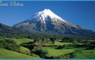
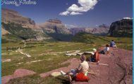
What’s Best: A tucked-away 500-acre nature preserve close to Fairfax, featuring a cascading creek and trails to the steep ridges that rise above it.
Parking: From Hwy. 101 take San Anselmo-Sir Francis Drake Blvd. exit and proceed west on Sir Francis Drake about 6 ml, past San Anselmo. At Fairfax, veer left on Broadway, to center of town, and turn left on Bolinas Rd. After a short .5 ml. on Bolinas Rd, veer right on Cascade Dr. to its end. Limited on-street parking. Agency: Marin County Open Space District
CASCADE CANYON MAP SAN FRANCISCO Photo Gallery

Hike Elliott Nature Preserve (.5 ml.); Cascade Falls (1.75 ml.); Cascade : Canyon Road to Sargent cypress forest (5.5 ml.)
The Elliott Nature Preserve is an inviting glade just beyond the entrance to Cascade Canyon Preserve, washed by Cascade Creek and fringed by Douglas fir, oak, and madrone. A trail, broken at times by the creek’s high water flows, leads through the center; a road goes to the same place but stays out of the creekbed. For both hikes, continue straight, avoiding left-side trail options. You’ll reach a bridge, a little more than .5-mile from the trailhead. For Cascade Falls, cross the bridge and veer right up the creek. You’ll ascend gradually for about .25-mile before reaching the falls a 20-foot-high cataract spilling over shaded bedrock into a pool.
On the Cascade Canyon Road to Sargent cypress forest hike, you climb 1,200 feet to the open San Geronimo Ridge Road, near Pine Mountain. Go left on road after crossing the bridge. At the outset, avoid a spur trail to the left that heads up San Anselmo Creek. Continue up Cascade Canyon Road, the reddish scar you can see from the Elliott Nature Preserve. It is also called Repack Road because its bumpy surface causes cyclists to repack their wheel bearings after coming down. After 2 miles of a direct assault on the ridge through chaparral, you come upon San Geronimo Fire Road. Going left here connects with Pine Mountain Road, TH42. To the left and right of the junction, you are in the Sargent cypress forest; the dwarf conifers are unique to California, some of which are more than 100 years old.
BiKE: Thrill seekers who want to find out why they call it Repack Road can try a 5-mile Cascade Canyon loop, a little more than half of which is via surface streets. Park on Cascade Drive, where it veers off Bolinas Road, and start riding up Bolinas. About 3 miles later after climbing 700 feet over 1.25 miles and entering MMWD lands turn right at trailhead for Pine Mountain Road. Take this rocky road, pumping up 400 feet and passing the Oat Hill Road on your left. Go straight on San Geronimo Road as Pine Mountain makes a left. About .25-mile later, look for Repack Road, a.k.a. Cascade Canyon Road, going down to your right. Hang on down to the bottom, cross the bridge at Cascade Creek and ride out to the MCOSD trailhead at Cascade Drive. It’s about 1.5 miles to rejoin Bolinas Road.
Yahoo cyclists can also charge up Blue Ridge Road, via Middle Fire Road, which takes off to your right just before the bridge on Cascade Creek, as described in hiking section. Blue Ridge Road takes you over White Hill and then connects with San Geronimo Ridge Road a mile north of Repack Road. You turn left on San Geronimo Road, climb 1,000 feet, and reach Repack your return route. The route up to White Hill from Cascade Canyon via Blue

