
WHITECOURT MAP EDMONTON
Directions: Exit Edmonton on Hwy 16 west, turn north onto Hwy 43.
Distance: 181 km, or about 2 hours, from Edmonton.
Info: www.whitecourt.ca.
Whitecourt’s first inhabitants, the Woodland Cree, called the area sagitawahwhere the waters meetbecause four waterways come together on the eastern border of the Rocky Mountain foothills: the Athabasca River, McLeod River, Sakwatemau (Eagle) River, and Beaver Creek. Whitecourt is located at the convergence of the Athabasca and McLeod rivers.
Early explorers and residents used these rivers for transportation, and in 1897 the Hudson’s Bay Company built a trading post near the present-day location of the Whitecourt Golf and Country Club. Some of the Klondike gold prospectors who stopped here to collect supplies and rest later returned as settlers.
By 1908 the Whitecourt region was finally surveyed into quarter sections. For $10 settlers could file for land. Some signed for land they had squatted on; others purchased land they had not yet seen. Title ownership required spending six months of three consecutive years living on and farming the property. Aiming to lure pioneers west, the Canadian government advertised heavily in Europe and the US, but poor transportation routes meant difficult travel. One family en route to Whitecourt from Edmonton took four weeks to make the trip. Settlers ofen worked on roads in return for tax deductions.
When a post office was established in 1910, some settlers wanted the community to be called Sagitawah or McLeod River Flats. Instead, it was registered as Whitecourt, presumably after mail carrier Walter White from Greencourtwhere Whitecourt’s mail had originally been sent. Having expected that they would be able to vote on the town’s name, residents were upset, but they let the name Whitecourt stand to avoid slowing post office approval. Train service became available in 1921, providing one-day service to Edmonton. Because of the railroad, the lumber industry began to thrive, and more settlers came to the region.
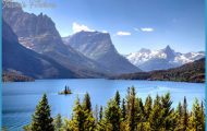
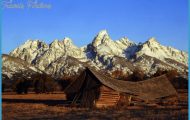
Today Whitecourt has a population of more than 9,600. With 11,000 square kilometres of forest surrounding the town, the area offers seemingly unlimited opportunities for outdoor enthusiasts, and the town is known as the Snowmobile Capital of Alberta. The rivers are ideal for those who enjoy paddling a canoe or kayak, boating, and fishing. Many enjoy tubing down the McLeod River. (Ask at the Whitecourt and District Forest Interpretive Centre visitor information for a map, conditions, and directions.)
The town of Whitecourt has more than 50 kilometres of trails and paved pathways that connect residential, downtown, and forested areas between the valley and hilltop. The surrounding area has hundreds of kilometres of trails designated for off-highway vehicles.
If you are interested in picnicking in town, visit Rotary Park, (51st Street) which has areas for picnicking, sports fields, playgrounds, and asphalt trails around a pond. Fishing is permitted from May to October, but is limited to individuals younger than 16 years of age and those accompanying these children. Be sure to check out the unique Whitecourt River Slidea creek built for tubing and play, with pools and drops leading to a shallow basin and beach; and the splash park in Rotary Park (541551 st Street). The Friendship Park, downtown (491651 st Avenue), recognizes the bond between Whitecourt and its sister town, Yubetsu, Japan. Riverboat Park (1 River Boat Park Road) on Whitecourt’s west edge has a picnic area, shelter, and boat launch that provides access to both the McLeod and Athabasca Rivers. Centennial Park (1 Beaver Drive), on Whitecourt’s south boundary, is a large green space with numerous walking trails.
WHITECOURT MAP EDMONTON Photo Gallery


