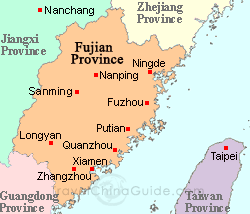
Province: Fujian. Area: 10-5sq.km/4sq. miles Population: 480,000 (conurbation 960,000)
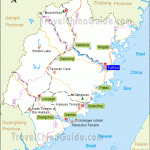
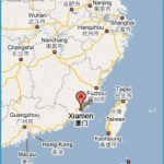
Situation and Xiamen lies in the south-east of Fujian province, at 118°07’E and 24°25’N. It
Communications can be reached by rail from Shanghai, or by air or ferry from Hong Kong.
There are also flights to Beijing.
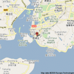
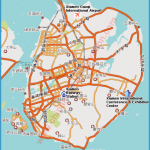
Xiamen’s ancient town centre-Amoy in the Fujian dialect-on the island of the same name is joined to the mainland by a long causeway built in 1956. Xiamen has a favourably-located natural harbour.
Xiamen Harbour
Being situated in the subtropical zone, this coastal town enjoys a very mild maritime climate.
Xiamen was founded in 1394 to provide a defence against pirate attacks; later it became a sea-port. It was named Xiamen after the original fortress of Da Xia Zhi Men, known as the “Gateway to the Great Edifice”; the term “Great Edifice” refers to China itself. General Zheng Chenggong (1624-62) set up a naval base here. In 1842, after China had been defeated in the Opium Wars, Xiamen became one of the five free ports which the government was forced to open up to international trade.
By the mid-1950s it had developed into an important industrial centre. Since 1980 Xiamen has been one of the four Special Economic Zones, where a kind of free market economy operates.
The botanical gardens known as the Park of Ten Thousand Rocks lie on Lion Mountains (Shishan) in the east of the town. The dominant features of the park are bizarre-shaped rocks, lush vegetation, caves, temples and pavilions. There is also an artificial lake ofthe same name.
Particularly interesting are theTemple ofthe Kingdom of Heaven (Tianjie Si) and the nearby Chang Xiao Dong caves which contain inscriptions dating from the Ming period (1368-1644).
South Putuo Temple, at the foot of the Mountain of the Five Old Men (Wulaoshan) in the south of the town, was built during the Tang dynasty (618-907).
In the front hall stand statues of Maitreya Buddha and the Four Heavenly Kings.
Three further Buddha figures and one of Guanyin are to be found in the Sumptuous Hall of the Great Hero. Statues of Guanyin can also be seen in the Temple of Dabei Tang.
In Cangjing Ge Pavilion there are some interesting writings and a bell from the Song period (960-1279). In the University of Xiamen is a memorial to the writer Lu Xun (see Famous People), who lectured here in 1926-27.
The Island of the Blown Waves, 2sq.km/3/4sq. mile in area and lying 1 km/1100yd south-west of Xiamen, boasts some pretty little houses in the midst of rich flora, which has led to their being popularly known as “Gardens of the Sea”.
Dominating the island is Sunlight Rock, also known as the Peak of Flying Sparks (Huang Yan) or Dragon’s Head Hill (Longtoushan). A Buddhist temple stands at the foot of it.
In 1962 this memorial hall (Zheng Chenggong Jinianguan) was built on the north side of the island in honour of the national hero of that name who had liberated Taiwan from the Dutch three hundred years earlier.
South of Sunlight Rock lie Shuzhuang Gardens, which once belonged to a Taiwanese businessman who moved to Gulang Yu Island in 1895 after his home had been taken over by Japanese. Gangzihou beach is to the west.
The Cave of the White Stag lies hidden on the southern slopes of Mount Yuping to the north-east of the town. Two wall inscriptions bear witness to the resistance put up by the local populace against its Dutch masters in the first half of the 17th c. In the middle of the cave stands a white clay sculpture of a stag, the symbol of the School of the White Stag on Mount Lushan, which was founded in the Song era (960-1279) and devoted itself to the study of the classical writings of Confucius.


