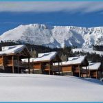
What determines how far up a mountainside trees will grow? This depends on the latitude and the characteristics of the particular mountain. Factors such as rainfall, amount of wind and sun, temperature, steepness, and type of soil also affect tree growth. At Yellowstone’s latitude (44-45° N), timberline is usually at 9500 to 10,000 feet (2900-3050 m). However, the upper slopes of the mountains you see in this part of the park are so steep that trees cannot grow even at 8500 or 9000 feet (2600-2750 m). Botanists use the word timberline for the upper limit of fully erect trees and the expression tree line to mean the upper limit of all trees, including those that are stunted. Why Do the Mountains Look Striped? On all the nearby mountains, you can see stripes or horizontal layers, which are highlighted until midsummer by bands of snow. Abiathar Peak east of the road is layered by chocolate-colored lava flows and volcanic mud flows that were part of the Absaroka volcanic outpourings about 50 million years ago [GEO.5]. Facing Abiathar from west of the highway is Barronette Peak [GEO.2], which is also topped by similar chocolate-colored volcanic layers.
The lower slopes of Barronette, however, consist of buff to gray layers of ancient sedimentary limestones that are about 350 million years old. Similar sedimentary rocks underlie Abiathar Peak, but they are dicult to see from the highway. All of these rocks are practically undeformed and are still lying in nice horizontal layers, a phenomenon sometimes called layer-cake geology. for Yellowstone Jack Baronett, who came to the area in 1864 to prospect for gold. (See also Baronett’s Bridge and Its Successors, 210.) The misspelling of his name by members of the 1878 Hayden Expedition later became the ocially approved name of this peak. In the 1880s a former miner named Red Sowash built and ran a saloon in this meadow. Early in the season, you can see dozens of small waterfalls catapulting off Barronette Peak. The trail marker appears partway up the trail. A rather steep but rewarding hike of about 1 mile (1.6 km) round trip takes you up a hillside strewn with wildflowers to a sparkling mountain lake with meadows on two sides. Trout Lake was called Fish Lake when it was a major source of food for Cooke City residents. Some of the early residents broke the law and killed trout with charges of dynamite. There’s an abundance of trout in this deep lake, but they’re not easy to catch. Remains of an old weir or fence for catching fish are still at the lake’s outlet, a remnant from the days when fish eggs were collected here. 13.0/15.6 Soda Butte. This landmark is worth a short stop, especially if you’re entering the park for the first time.
It’s the lone thermal feature in this corner of the park. Soda Butte is an extinct hot spring cone made of travertine, the same rock that forms Mammoth Hot Springs’ terraces. Although it has not done any cone building during recorded history, it or its neighboring hot spring often gives off an odor of hydrogen sulfide. Prospector A. Bart Henderson named Soda Butte in Soda Butte imitates the shape of Abiathar Peak a few miles away. 1870. He mistakenly thought the feature was made of sodium carbonate, or washing soda. Pieces of it shine like marble. Take the path behind Soda Butte to The mountain to the northwest here is Druid Peak. If you’re traveling west, this is the last you will see of the striated lava-topped mountains so common in this part of Yellowstone. From about this point to the Lamar Canyon (mile 20.8/7.8) is the area where you are most likely to see wolves or to see a colony of cliff swallows. The see of warm water here was called Soda Butte Medicinal Springs by Superintendent Norris. see people with spotting scopes looking for wolves. The most visible wolf pack since the reintroduction of wolves into Yellowstone has been the Druid Peak pack. The best viewing times are early and late in the day. Special Caution: Stay at least 100 yards (109 m) away from wolves (new regulation 2008).

