
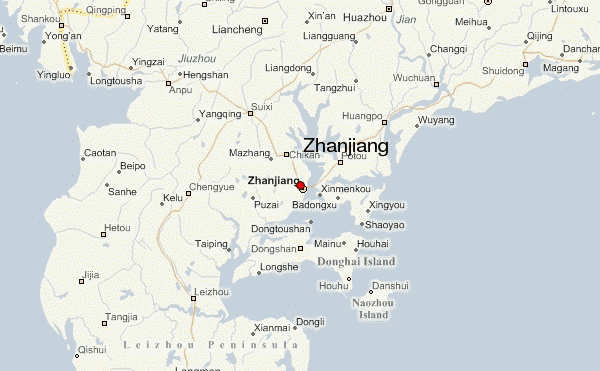
Province: Guangdong Area: 12,OOOsq.km/4630sq. miles. Population: 4,600,000
Zhanjiang lies in the south of Guangdong province, at 10°21’E and 21°16’N. There are buses from the provincial capital Canton and trains from Guilin and Nanning. The town also has a sea-port and ships ply between here and Canton, Haikou and many other south-east Asian harbour towns. Situation and Communications
Although still quite a young town Zhanjiang has already experienced many adversities in its short history. In 1898 it was occupied by the French and in 1943 by the Japanese. In 1945 the Chinese again took control. In 1984, together with fourteen other harbour towns, it was opened up to international trade. History
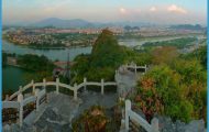
Lake Huguangyan, of volcanic origin and lying 20km/12’/2 miles south-west of the town, covers an area of 3-6sq,km/1-4sq. miles. Its banks are studded with a number of old monuments and buildings, including the well-known Lengyan Monastery (Lengyan Si) from the Song period (960-1279). Above this temple towers a large rock on which Li Gang (1083-1140) -who occupied a number of important posts under the Song dynasty and was made chancellor – wrote the name of the lake in three Chinese characters. Surroundings Lake Huguangyan


