
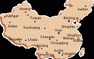
Zhengzhou lies in the north of Henan province, south ofthe Huanghe and east ofthe Songshan rivers, at 113°39’E and 34°43’N.
As the city stands at the junction of China’s two major rail routes, the Beijing-Canton and Lianyungang-Urumqi lines, it is accessible by train from almost any large town in the country. It is also possible to fly here in a few hours from Beijing, Shanghai, Canton, Xi’an and other cities.
Zhengzhou is one of China’s oldest cities. Archaeological digs have revealed important Neolithic finds and the ruins of a 3500 year-old town wall built in the Shang period (16th 11th c. B.c.).Thetotal length ofthiswall was more than 7km/4!/2 miles, it was 9m/30ft high and over 30m/99ft at the base. Zhengzhou expanded considerably under the Western Zhou (11th c-770 b.c.). It was given its present name in 559 b.c. After the construction of the two above-mentioned railway lines in the early 20th c. Zhengzhou enjoyed rapid economic growth. It played a central role in the 1923 rail strike, the “Strike of February 7th”. As well as being the political, cultural and business centre of Henan province it is also an important north Chinese industrial centre (metalworking, machinery).
In 1971 a monument was erected in the city centre to commemorate the General Rail Strike which began on February 7th 1923 and was violently suppressed three days later with much bloodshed. The double pagoda, 63m/207ft high, is polygonal in plan. Documents relating to the events of the time are on display.
The Provincial Museum in the city centre exhibits Neolithic finds, especially those ofthe Yangshao and Longshan cultures. Further exhibits relating to the history ofthe Revolution which commenced with the rail strike can also be seen.
The Public Park lies on the banks of the Huanghe, to the west of the Provincial Museum. Its pavilions and covered walkways make it a popular spot with the local inhabitants.
Mount Mangshan rises up on the banks ofthe Huangshe 30km/19 miles north-west of Zhengzhou. Here can be seen a pumping-station built in 1972 which provides the city with water.
From the top of the mountain there is an impressive view of the river.
These two tombs from the Eastern Han period (a.d. 25-220) lie in the village of Dahuting in the Mixian district, 30km/19 miles south-west of Zhengzhou. A governor and his relatives are buried here. The frescos in the tombs show scenes from the lives of the deceased.
More than 3000 years ago Anyang, some 190km/120 miles north of Zhengzhou, was the capital of the Yin or Shang dynasty. For 273 years it was a major centre of power, but after the fall ofthe Shang dynasty it also soon went into decline. Ruins of the town near the village of Xiaotun were first excavated in 1899. Many valuable archaeological finds came to light over an area measuring 8km/5 miles from east to west and 3km/2 miles from north to south; these included more than 100,000 carvings and inscriptions on tortoise-shell and ox-bones as well as bronze objects,
Also near Anyang lie the ruins of the town of Youli, which is known to have existed back in the time of the Zhou (11th c-771 b.c.). At that time the Zhou King Wenwang often came here to take part in prophecy rituals. Apart from the original terrace all the buildings which have survived were rebuilt in later centuries. Of particular interest is the Stele of the King with its 64 hexagrams which are described in detail in the “Yi Jing”, or “Book of Changes”. It gives many clues to the prophetic and fortune-telling practices employed in China more than 2100 years ago.
Zhengzhou Map Photo Gallery


