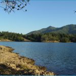
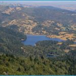
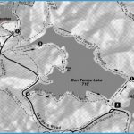
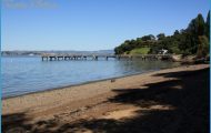
Bon Tempe Lake hike: Head up a short connector road from the parking area, toward the Shadyside Trail and walk across the wide dam that forms the west shore of Bon Tempe Lake. Bon Tempe is a more recent reservoir, built in 1948 75 years after flagship Lake Lagunitas (out of view to the southeast) and 30 years after Alpine Lake, whose easternmost shore is visible below the dam to your right.
BON TEMPE LAKE MAP SAN FRANCISCO Photo Gallery
The Alpine Lake-Hidden Lake loop takes you along 2 miles of lakeshore before beginning an inland swing to the ridge above both lakes. Bear right after you cross the dam, on the Kent Trail. You begin close to lake level, but then the trail ascends through redwood and Douglas fir forest. About 2 miles from the dam, where the Helen Markt Trail continues along the lake, hang a left on the Kent Trail. You’ll climb some 400 feet over the next mile, amidst redwoods, laurel and oaks and come to the Stocking Trail, where you want to go left. Walk through a hollow containing Hidden Lake, which is now a bog, and reach Rocky Ridge Road. Go left on this road, coming to the hike’s high-point and view area after a short distance. Then begin the tromp back down to lake level.
Lake Lagunitas hikes: The Lake Lagunitas shoreline loop is a lovely lakeshore walk among redwoods, ferns, and a variety of trees. Cross the bridge to the far right in the parking area. Then bear left on the road, ascending gradually through mossy forest. You’ll come to the dam, which has a decked viewing area that can be crossed to make a short loop back to the parking area. Continue, with the lake to your left, walking under the boughs of large Douglas fir and crossing a series of footbridges. After the third bridge, you reach Lakeview Road a drier area with madrones and oaks. After .25-mile on the road, bear left at a picnic area and take a trail that leads back to the dam. From the dam, walk down through the redwoods to trailhead parking.
On the Pilot Knob loop you’ll get splendid views of Lake Lag and vistas all the way to the East Bay. Walk up the road to the left of the stream from the parking lot to the dam, and bear left on a trail to join Lakeview Road. After about .5-mile, make sure to stay left on Lakeview, rather than go right on the road that goes around the lake. In another .5-mile, go left on Pilot Knob Trail. The trail rises gradually through oak, madrone, and some firs for about .25-mile to where a spur trail leads left. The spur goes to 1,200-foot Pilot Knob, taking you up some 250 feet in short order. Backtrack down the spur trail, and go left again, and rejoin Lakeview Road.
Bike: The Sky Oaks lakes are on the circuit for loop rides that connect with Phoenix Lake, TH47. For one short and interesting option of a little more than 3 miles begin on Concrete Pipe Road, which goes south from Bolinas
Road from the intersection with Sky Oaks Road. You’ll see a gate, with limited on-street parking. After about 1.5 miles of contour, you reach Five Corners, above Phoenix Lake. Turn right, up Shaver Grade, climbing about 250 feet in .5-mile. You come to Sky Oaks, where you turn right and ride out to Bolinas Road. You might do this loop in combo with taking the continuation of Concrete Pipe Road on the other side of Bolinas Road which is sometimes called Pine Mountain Tunnel Road. You ride a wiggling contour for about 1.5 miles, to Happersberger Point, which overlooks Cascade Canyon.
Another Sky Oaks’ option is to bomb down Southern Marin Line Road, that takes off to the east from just north of the Lake Lagunitas parking area. You drop down almost 200 feet and come to Eldridge Grade after about 1.25 miles. Go left on Eldridge, dipping down and then up a little, covering .75-miles and reaching Five Corners. From Five Corners you can go short and steep to the left on Shaver Grade to Sky Oaks Road; or veer left and contour on Concrete Pipe Road, out to Bolinas Road. From Bolinas Road you go left up Sky Oaks Road about 1.5 miles back to the Southern Marin Line Road. The long version, via Concrete Pipe, is about 6 miles.

