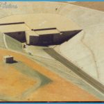
One of the most closely guarded secrets of Area 51 during the Cold War era didn’t involve American airplanes but Soviet ones. Beginning in 1967, an Air Force program known as “Red Hat” was established to test captured, stolen, and otherwise surreptitiously obtained Soviet aircraft to determine their capabilities and weaknesses. Among the craft tested here were the MiG-17, MiG-21, MiG-23m Su-22, and S7-27. Efforts are still being made to obtain the latest military aircraft from both Russia and China (usually by bribing corrupt officials). In fact, Red Hat has never been officially acknowledged to exist, but numerous daytime photographs of Soviet aircraft in the air over Area 51 (and a photo of a MiG-21 on the Area 51 runway, taken from an area now closed to the public) have provided conclusive proof that such craft are here.
There are rumors of many other weapon systems, such as “directed energy” weapons, being tested here but those reports can’t be confirmed. It is more likely that such weapons are actually tested in other areas of the Nellis Range Complex.
Getting a Look Inside: It’s easy to get badly lost in the maze of gravel roads around Area 51. Copies of maps and viewing guides are for sale at the Little A’Le’Inn and are a must if you decide to travel off either of the two main roads leading to the base.
Area 51 Zone Photo Gallery
The only look “inside” Area 51 is now from the summit of Tikaboo Peak, a 7,800-foot-high mountain located approximately 26 miles from Groom Lake. The top of Tikaboo offers a view of the facilities at Area 51 and much of the Nevada Test Site. However, the climb to the summit of Tikaboo Peak, while not requiring mountain-climbing skills, is strenuous and you need to need to be in good physical condition before attempting it.
It cannot be stressed enough that you must not cross over the boundary of Area 51 under any circumstances; even if you do so by accident, you can expect to be detained by the Cammo Dudes and turned over to the Lincoln County sheriff’s department for arrest. When this happens, you will be fined at least several hundreds of dollars and any film, videotapes, or other recording media you have will be confiscated. Away from the roads, the boundary is marked with orange posts spaced apart at distances ranging from ten feet (near the road) to 200 feet in the open desert. An accidental crossing of the border, even if the border is not clearly marked, will not be accepted as an excuse. Motion detectors are known to be in use along the border. Unless you are absolutely certain of where the border is, it’s always best to keep a safe distance.
Most visitors content themselves with simply driving to the border of Area 51 and glimpsing the warning signs and Cammo Dudes. The closest entrance to Rachel is the so-called “North Gate.” The road to the North Gate begins approximately 1.4 miles south of Rachel near mile marker 11.4; on maps this may be identified as Valley Road or Groom Road (do not confuse this with Groom Lake Road!). While the road is generally well maintained, slow, careful driving is recommended since large rocks can cause flat tires. Follow the road for a little over ten miles until the guardhouse comes into view. Watch carefully for the warning signs as you approach the guardhouse; you will need to stop well before the guardhouse to avoid entering Area 51. If you are speeding, or fail to note the signs (a very real possibility if you are approaching at night), you may cross over the border without realizing it.
The North Gate is the newer entrance to Area 51 from Highway 375. It seems to be the preferred entrance for trucks and other heavy vehicles. While visiting the North Gate when researching this book, I was parked along the access road just short of the Area 51 border. In my rearview mirror, I noticed a large 18-wheeler truck traveling down the road toward the border and me. This was not your typical truck. It was painted (both cab and truck) gleaming white and I could see no markings of any sort. As it approached closer to my parked car, it began veering closer and passed me with only a couple of feet of clearance between our vehicles. As it passed, it kicked up a lot of dust, making it impossible to see the driver. I searched for any lettering on the side of the cab and truck but could see none. However, I did notice that the truck had a U.S. government license plate. Judging from the “brushback” he gave me, the driver was not too pleased to see me near the gate.
The Main Gate is located south of Rachel and is the most visited place on the Area 51 boundary. The easiest way to reach the main gate is via the Groom Lake Road, a graded gravel road similar to the one leading to the North Gate, located approximately 24.5 miles south of Rachel on Highway 375; it is a little over five miles south of the Black Mailbox. Groom Lake Road is unmistakable; it is a long, straight road leading toward the west and Area 51. Satellite photos indicate that this road continues through Area 51 into the Nevada Test Site and eventually to Highway 95.
It is also possible to reach the Main Gate from the road beginning at the Black Mailbox, but this is not recommended. That road will eventually take you to an intersection of three different roads, and failing to take the correct road will send you away from the Main Gate (see “Unusual Fact” below for an example of the possibly hilarious consequences of the wrong choice).
The distance from Highway 375 to the Area 51 border is just short of 14 miles. While there are several other gravel roads intersecting with Groom Lake Road, you travel straight on the road and make no turns. As you approach the border, the surrounding terrain will get hilly and you can often see the glint of reflected sunlight from a Cammo Dude truck on one of the hills inside area 51. Slow down and be alert for warning signs on both sides of the road; the boundary is not blocked by a security gate (as is the case at the North Gate) and the guardhouse is not visible from the Main Gate border it is around a bend in the road approximately a half-mile past the boundary. Once again, you should not cross past the warning signs under any circumstances! If you drive past them to the guardhouse, you will be detained and placed under arrest. Stop short of the border, turn around, and park well over to the side of Groom Lake Road so as not to block traffic.
You will be under both video and human surveillance at the Main Gate. During daytime, you usually won’t be bothered by the Cammo Dudes as long as you don’t act suspiciously or hike away from the road area (you might even find them hospitable; I have looked at them through binoculars while they looked back at me through their binoculars, I waved at them, and received a friendly wave back). But you are likely to be photographed or videotaped at the Main Gate. I have managed to videotape a Cammo Dude pointing what seemed to be a video “handy cam” at the Main Gate area, panning back and forth in a way that allowed him to capture the license plates of cars and faces of me and other visitors.
The Cammo Dudes get more active and aggressive if you hike away from the road or visit at night. The “rules of engagement” seem to be that anyone approaching the border on foot or at night is presumed to be intent upon crossing the border. If you hike toward the border on foot, you will be followed by Cammo Dudes and may encounter some along your path. If you drive toward the Main Gate at night, or are parked near the boundary at night, you may find yourself followed by a Cammo Dude truck or have a Cammo Dude truck park behind you. You may also be buzzed by low-flying helicopters.
There is also anecdotal evidence that the Cammo Dudes get more aggressive when some exceptionally secret activities are going on at Area 51. People have found Groom Lake Road blocked by Cammo Dude trucks, have been closely followed, or have been subjected to questioning and intimidating behavior (such as display of weapons) when parked near the Main Gate. And campers on land near the boundary have been awakened in the middle of the night by Cammo Dudes near their campsites. Such incidents are comparatively rare, however.
Prior to 1995, it was possible to get a good view of the facilities at Area 51 from two hilltops known as Freedom Ridge and White Sides. Trails to these viewpoints were described in some guides to Area 51, and directions to these hilltops can still be found on some Web sites. However, these hilltops were added to Area 51 in April 1995, and it is now illegal to hike to them. Warning signs have been placed at the beginning of the old trails to Freedom Ridge and White Sides and orange posts mark the border. Do not attempt to climb to Freedom Ridge or White Sides as these are heavily monitored!
As mentioned earlier, Tikaboo Peak is the only spot left to get a look inside Area 51. It is a backpacking trip with no established trail (rock “ducks” mark the route) and, depending on the condition of the road to the trailhead, a four-wheel drive vehicle may be required. Snow is common during the winter. At the summit, you will need high-power binoculars (such as 20x magnification) or a spotting telescope to see any detail. Haze or other weather conditions may make getting a decent view impossible. On clear days (and nights), however, you will get an unobstructed view of Area 51 and the airspace above it as well as a large portion of the Nevada Test Site. Scanner radio reception is also excellent from the summit.
It is possible to get a good view of the airspace over Area 51 and S-4 from several locations on Highway 375 south of Rachel. During the day, you’ll see readily identifiable military aircraft (and hear an occasional sonic boom) but there have been no reliable reports of UFOs, or even possibly secret aircraft, in daylight. The real action here takes place at night. Even if you don’t believe in UFOs (or secret aircraft), the skies are filled with military aircraft performing combat maneuvers, flares, and other sights that are fascinating. There is often a myriad of unusual lights on most nights, especially after midnight. Depending on your perspective, these lights are conventional military aircraft and weapons systems, top-secret aircraft undergoing tests, UFOs, or maybe all three. The most active time to see things is during the normal Monday to Friday workweek, with late Wednesday night and early Thursday morning reportedly being best. This would make sense for testing programs; Mondays and Tuesdays could be used to set up the tests, and the results could be evaluated on Thursdays and Fridays.
Unusual Fact: Area 51 was officially pronounced closed and abandoned in the June 1997 issue of Popular Mechanics magazine; according to that article, the Air Force had shifted its top-secret aircraft tests to the Green River Launch Complex in Utah (see the entry for it in the UTAH section). But, as the satellite photos prove, Area 51 is still very much in business and (as any visitor will quickly discover) as heavily guarded as ever. So what got into Popular Mechanics?
Jim Wilson, the science and technology editor of Popular Mechanics, wrote the article. According to his report, Wilson turned at the Black Mailbox toward Area 51. He followed the road to its end and found no guardhouse, no Cammo Dudes, no warning signs other than generic “no trespassing” signs and warnings that the area was used for live bombing practice. There was only a cattle gate “the sort you can buy at K-Mart,” as he described it closed with weathered locks and rusting barbed wire. The road disappeared shortly after the gate. From such evidence, Wilson concluded Area 51 had been closed and was no longer used.
When the magazine hit the newsstands, Internet chat rooms and message boards were quickly abuzz with speculation. Since Area 51 was still in operation, was the article a piece of Air Force-sponsored disinformation? Was the Air Force laying the groundwork for a possible relocation of Area 51? Was Jim Wilson some sort of covert government operative? (Certainly, the Top Secret Government had to have been pleased by anything that discouraged visitors to Area 51.)
The truth turned out to be simpler and much funnier: Jim Wilson got lost and instead arrived at the gate for Area 61, a section of the Nellis Range Complex used for live bombing missions. He had driven down the road from the Black Mailbox, chose the wrong road at the intersection, and drove away from Area 51 and toward the gate to Area 61! Surprisingly, Wilson mentions using a map and a compass in trying to find Area 51 in his article. Since these skills are not often required in the New York City metropolitan area (unless your cab driver arrived last week from Bangladesh), perhaps he was a bit out of practice.
Area 61 is located south of Area 51 and you could, in theory, travel across it to Area 51. However, you would run into the same heavy security that you do when you approach Area 51 from any direction provided that you managed to get that far. Area 61 is littered with live, unexploded bombs and shells, and there’s a good chance that anyone trying to cross it on the way to Area 51 would be blown to bits long before running into the Cammo Dudes.
What was the aftermath of this story once Wilson’s huge blunder became widely known? Did Popular Mechanics run a retraction or correction of the story? No. In fact, the article was still proudly posted on their website over five years later as an example of the outstanding journalism and accurate reporting you can find each month in the pages of the magazine. But let’s be fair in this analysis. Maybe Popular Mechanics isn’t the best place to look for information on Area 51, but I would never buy a riding lawnmower without first consulting their reviews.
Getting There: From Las Vegas, take Interstate 15 east until you reach the intersection with Highway 93. Travel north on Highway 93 for a little over 90 miles until you reach its intersection with Highway 375 north of Ash Springs. Look for the “Extraterrestrial Highway” signs at the intersection and follow Highway 375 north.
From Tonopah, take Highway 6 east for 50 miles and then turn south on Highway 375 for 60 miles to Rachel.
All routes into Rachel involve travel over roads with few gas stations, and gas is not always available in Rachel, especially at night. It’s wise to top off your tank before leaving for Rachel and at every opportunity along the way, especially if you’re traveling at night. Your car also should be in good working order with a full-size spare or an emergency tire inflation kit; extra water, food, and warm clothing can make the difference between an irritating delay and a life-threatening situation. This is very isolated country as a brochure from the Nevada Commission on Tourism notes, “If a dozen cars traverse the 98-mile stretch of U.S. 375 in a day, it qualifies as rush-hour traffic.” You will be out of cell phone coverage for much of the road. This is not the sort of trip you should make on the spur of the moment from Las Vegas plan ahead!

