County: Bornholms amt.
Area: 587 sq. km (227 sq. miles). Population: 47,000.
Samvirkende Bornholmske Turistforeningers Bureau (SBT), Havnen (the Harbour),
DK-3700 R0nne; tel. (03)95 0810.
Round church, 0sterlars (Bornholm)
RECREATION and SPORTS. Hire of bicycles; riding, tennis, golf, fishing, scuba diving, windsurfing, sailing.
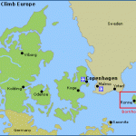
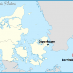
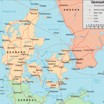
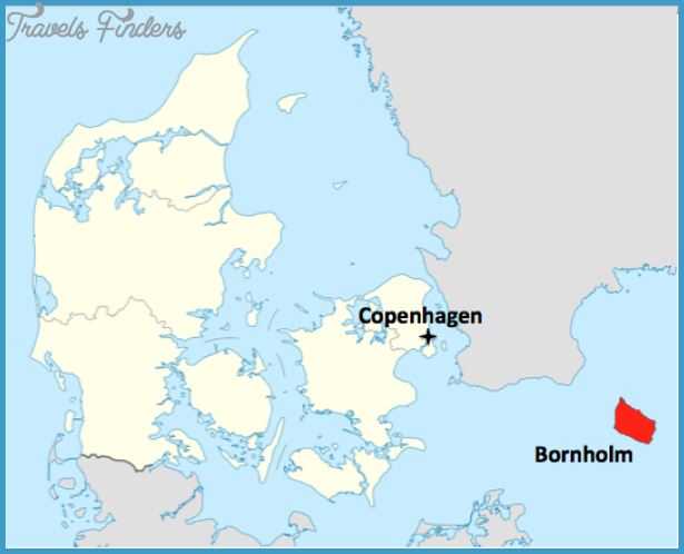
The Baltic island of Bornholm, lying 37 km (23 miles) off the Swedish coast and 150 km (95 miles) from Copenhagen, has belonged to Denmark since 1522. In medieval times it was an important trading post. The present-day population lives mainly by fishing, fish-processing and farming; but the island’s mild climate and good bathing beaches have also promoted the development of a lively holiday and tourist trade.
ACCESS.-Ferry services to Ronneon Bornholm from Copenhagen, Ystad in southern Sweden, Lubeck-Travemunde (German Federal Republic) and Sassnitz (German Democratic Republic). Air services between Copenhagen and R0nne.
The island consists of a great mass of granite, much of it with only a thin coating of soil, bounded on the N by fine steep cliffs and on the SE and W by dunes. The interior is partly wooded, partly heath-land. Its most notable remains ofthe past are four fortified round churches of the 12th and 1 3th c.
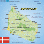
Tour of the island. The capital of Bornholm is Ronne (pop. 15,300; Fred-ensborg Hotel, 106 Griffen, 284 SB, SP; Badehotel Ryttergcirden, 224 SB; Dams Hotel, 91 youth hostel; camp site), which also has the island’s airfield and its principal harbour. In the oldest part of the town stands St Nicholas’s Church (originally 14th c. largely rebuilt 1918).
At 29 Sct.-Mortens-Gade are the Bornholm Museum, with good natural history collections and material of local interest, and the Museum of Art. The Castle, to the S of the town, was built about 1 650, and has a massive round tower (military area).
8 km (5 miles) NE of Ronne is the round church of Nyker (1287), the only two-storeyed church on the island. 9 km (5 miles) N of Ronne we come to the Brog-ardssten, the most important runic stone on Bornholm, and2 km (limiles) beyond this Haste (pop. 6900; Herring Festival at beginning of July), with a massive stone church (14th c.). 7 km (4Jmiles) farther N the road reaches the imposing granite cliffs on the coast, with the 40 m (1 30 ft) high crag known as Jons Kapel (John’s Chapel). The road then continues to the double village of Allinge-Sandvig (pop. 2100; Hammers© Hotel, 110 SP; Sandy Hook, 50 Imatra, 60 Gron-becks, 45 Hammers Pension, 25 SP; GaestgivergSrden, 32 NaesgSrden, 16 several holiday apartments; youth hostel; four camp sites), one of the most attractive swimming resorts on the island. There is a pleasant walk to the Hammeren lighthouse, to the N, passing the highest crag on the island, the Stejleberg (84 m 276 ft), and on from there to the ruins of ‘Hammershus Castle, to the SE of the lighthouse. The castle was built about 1250 and fiercely contested on many occasions; thereafter it was used as a quarry for building stone until it was scheduled as a historic monument in 1822. From the 74 m (240 ft) high crag on which it stands there are magnificent views. There are interesting boat trips to be made from Hammershus Hotel, for example to the Ifade Ovn, a cave 55 m (60 yds) long by 12 m (40 ft) high.
4 km (2i miles) S of Allinge is the round church of Os (built in the 12th c. restored 1 948-50), the tallest on the island (30 m1 00 ft). 11 km (7 miles) SE of Allinge are the Helligdom cliffs, and 6 km (4 miles) farther on lies the fishing village of Gudhjem (Casa Blanca Hotel, 53 SP; Stammershalle, 75 SP; Helligdommen, 45 S P; youth hostel; camp site), with a harbour blasted out ofthe rock.To theS is Qsterlars which has the largest round church on the island (11th c. with wall paintings of about 1 350). S of (Dsterlars extends the state forest of Almindingen, planted between 1800 and 1830, the scene of a forest run at the end of September; the forest contains a number of small lakes and the island’s highest hill, Rytterknsegten (162 m (530 ft): outlook tower). 20 minutes N are the ruins of Lilleborg Castle, which ranked with Hammershus as one of the two strongest fortresses on Bornholm.
7 km (4i miles) SE of Gudhjem, on the coast, are the wild Randkloveskar cliffs, and 8 km (5 miles) beyond this is the picturesque little fishing town of Sva-neke (pop. 1200; hotels: Siemsens GSrd, 89 Ostersoen, 35 Nansens GSrd, 14 youth hostel; camp sites), with old houses and a post-mill of 1 634. Festival of the Springs at the end of June. 3 km (2 miles) SW is the Braendesgardshaven amusement park.
The road S runs past the beautiful Paradisbakkerne (”Paradise Hills”) to the port of Nekso or Nexe (pop. 8950; Harbour Festival at beginning of August). 3 km (2 miles) S is Balka, with a beach of fine sand, and 7 km (4 miles) beyond this the southern tip of the island is reached; here are the Dueodde lighthouse, gently rolling dunes and a beautiful beach. 1 5 km (10 miles) inland we find the only town on Bornholm not on the coast, Akirkeby (pop. 7380; Kanns Hotel, 41 Dams pa Bakken, 36 Limensgade Molle, 15 holiday apartments; camp site), with a handsome 12th c. stone church (font with carved decoration and a runic inscription). The Church of the Rosary (Rosenkranskirken, 1932: R.C.) is one of the most attractive modern churches in Denmark. The road to Ronne (1 6 km 1 0 miles) runs via Nylars, with the latest and best preserved of Bornholm’s round churches (12th c.).
It is well worth taking a boat trip from Allinge, Gudhjem or Svaneke to Ertholmene (Pea Islands”). The principal island is Christians© (pop. 11 8), with fortifications of 1684. The neighbouring island of Frederikso was formerly notorious as a place of exile. Graesholmen is a bird sanctuary.

