
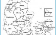
Province: Gotlands Ian.
Area: 3140 sq. km (1212 sq. miles).
Strandgatan 9 (only in summer); tel. (04 98) 1 09 82.
EVENT. Miracle play, Petrus de Dacia” (Visby).
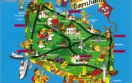
Gotland is the largest island in the Baltic, 125 km (78 miles) long and 55 km (35 miles) across at its widest point. It lies some 90 km (60 miles) from the mainland of Sweden and is separated from the island of Oland to the SW by an arm of the sea 55 km (35 ft) wide and up to 200 m (650 ft) deep. Once a famous Viking stronghold, the island has numerous important remains from the past including not only the famous standing stones (raukar) and Viking sites, but also the magnificent town walls of Visby and 92 churches, none of which were built laterthan 1350. For centuries the island played a major part in the Baltic trade, but with the founding of Visby by the Hansa League on the site of an early settlement the town became not only the greatest Swedish town, but the greatest and richest of all the towns in the Baltic. As a result, though it remained, for the most part, firmly Swedish, its authority was claimed and frequently held from time to time by Germans, Danes, Norwegians and the Dutch. The tourist trade is now one of its main sources of income: during the main summer season, therefore, it is advisable to book accommodation and passages on the car ferry in plenty of time.
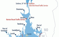
ACCESS. The ferry service between the island and the mainland of Sweden is run by the Gotland Company (Gotlandsbolaget, Box 8, S-62101 Visby, tel. 04 98 1 19 00). The shortest connection is between Vastervik or Grankullavik (Oland) and Visby (June to end of August only; 3 or 4 hours). There are services throughout the year between Visby and
Oskarshamn (about hours) and Nynashamn (55 km (35 miles) S of Stockholm: about 5 hours). From June to August there are connections between Copenhagen or Helsinki and Site (Finnlines). Air services by Linjeflyg, the Swedish domestic airline, between Gotland and 25 airports in mainland Sweden; the flight from Stockholm to Visby takes only 30 minutes.
Foreign visitors to Gotland should note that the northern part of the island and the two small islands of F3ro and Gotska Sando are restricted military areas. Foreigners may visit F3rd only on excursions organised by the Gotlandsresor or Reso firms. For a stay of more than 72 hours in the other restricted areas it is necessary to obtain a permit from the police or the military authorities in Visby.
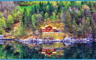
Gotland is a limestone plateau lying at an altitude of between 20 and 30 m (65 and 100 ft) with no lakes of any size and no rivers or river valleys, since the water seeps away quickly into the soil. The coasts are fringed by long sandy beaches or steep limestone cliffs, which often take the form of bizarrely shaped free-standing crags known as raukar (singular rauk). The Ice Age left its mark on Gotland in the shape of numerous erratic blocks of gneiss, granite and porphyry. Thanks to its mild climate the island has a varied and abundant plant life. It has large expanses of lush meadowland and arable fields; rather less than half its area is forest-covered. Even orchids flourish here. Sheep-farming is enjoying a new upsurge of prosperity. The only industries are cement works and the assembly of electronic apparatus. Prospecting for oil began in 1979.
HISTORY. Gotland, with its capital Visby, was long an important staging point on the trade route between Asia and Europe. Until the early 12th c. it remained firmly in the hands first of the Vikings and then of the Goths, who had also established a settlement at Novgorod in Russia. Thereafter its growing trade passed increasingly to Russians and to an even greater extent to Germans. In 1161 the Goths obtained a licence to trade with German territories, and in 1280 Visby and Lubeck formed a defensive alliance against piracy, which was also joined by Riga. The predominance of Visby in the Baltic trade was broken in 1293 when the Hanseatic League resolved that the German settlement in Novgorod should be allowed only to deal direct with Lubeck. Further difficulty was caused by armed conflicts between peasants and townspeople. In 1361 the island was conquered by the Danish King Valdemar Atterdag (betrayed, according to legend, by the lovesick daughter of a Visby goldsmith), and four years later it fell into the hands of the Vitalienbruder, a band of pirates supported by the duchy of Mecklenburg, who remained in possession until they were driven out by the Teutonic Knights in 1398. The Knights later (1408) sold Gotland to Eric of Pomerania, heir to Margaretha and ruler of the united Scandinavian kingdoms. From 1449 it was again under Danish sovereignty. In 1524 the Swedes and a year later Lubeck made unsuccessful attempts to conquer the island, and it did not become Swedish again until 1645, under the treaty of Brbmsebro. Thereafter it underwent two further periods of foreign rule from 1676 to 1679 by the Danes and in 1803, for 23 days, by the Russians. Little ofthe island’s former splendour and wealth has been preserved.
The island’s capital is Visby, on the NW coast (pop. 20,000; Visby Hotel, 160 Nya Hotell Solhem, 148 Snack-gardsbaden, 1 30 SP, sauna; Fritidsan-laggningen Kneippbyn, 105 Donners-plats Hotell, 43 holiday villages; youth hostel; camp sites), the city of ruins and roses, seat of the governor of the province of Gotland and the see of a bishop. Within its enclosing walls it has preserved much of its medieval atmosphere. Of its seventeen churches ten survive only as ruins, and services are still held in only one of them (St Mary’s). From the beginning of July to the middle of August the miracle play (with music) by Friederich Mehler, Petrus de Dacia, is performed about every other day in the ruins of St Nicholas’s Church.
SIGHTS. The most notable feature of Visby is the 3-5 km (2 miles) long circuit of town walls, built of limestone towards the end of the 13th c. and strengthened about 1300. At regular intervals in the walls are 44 towers standing between 1 5 and 20 m (50 and 60 ft) high. At two points there are large breaches in the walls one on the E side, probably the result of the Swedish attack in 1524, and the other caused by the insurgents from Lubeck a year later. On the seaward side is the Powder Tower (Kruttornet), probably dating from the 11th c. and incorporated in the later walls. Near the N end stands the Maiden’s Tower (Jungfrutornet), in which legend has it that the daughter of a goldsmith of Visby was walled up alive for betraying the town to king Valdemar Atterdag of Denmark. The adjoining corner tower is known as the Silver Cap (Silverhattan). From here the walls run E to the line of cliffs, turn S .at the main gateway (Norderport) and follow the edge of the cliffs to the Soderport at the S end of the town, and finally turn W to end at the ruins of Visborg Castle, overlooking the harbour.
From the harbour Hamngata leads to Donnersplatsen, with the Burmeisterska Hus, built in 1 652 by a Lubeck merchant named Burmeister, and which now houses the Tourist Information Office. Obliquely opposite is the Post Office. To the N, along Strandgatan, we come to the Museum of Antiquities (Gotlands Fornsal), with a fine collection of Viking and medieval material, tombstones and runic stones, arms and armour, furniture and religious art. Close by is the LUjehorn-ska Hus. Beyond Packhusplatsen, on the right, is the Clematishus, and then (No. 28) the Old Pharmacy (Gamla Apoteket), a 13th c. house with a crow-stepped gable (exhibition of arts and crafts).
Gotland Sweden Map Photo Gallery
