
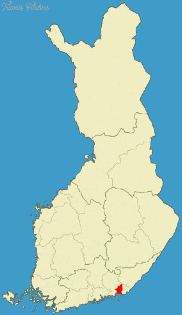
Province: Kymen laani (Kymmene lanKymi). Altitude: sea level. Population: 11,000.
Postal code: SF-49400. Telephone code: 952. ‘jNHaminan Matkailupalvelu, Pikkuympyrankatu 5; tel. 4 43 20 and 4 41 61.
Flag-Tower (in summer); tel. 4 15 81.
HOTELS. HaminanSeurahuone, Pikkuympyrankatu 5, 35 Hamina, Kaivokatu 4, 29 b. CAMP SITE.
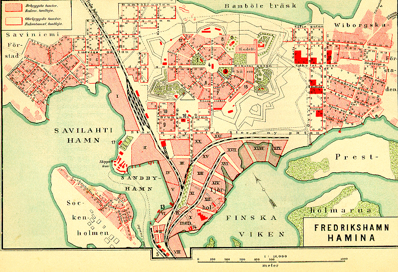
Hamina (Swedish Fredrikshamn), located on a peninsula in the bay of Vehkalahti, in the Gulf of Finland, is one of Finland’s leading exporting ports (timber products).
The town, founded in the 14th c. received its municipal charter in 1653. In 1723 it
was named Fredrikshavn in honour cf King Fredrik I of Sweden; the name Hamina came later. In 1809 Sweden and Russia signed the treaty of Hamina, under which Sweden ceded the whole of Finland to Russia. It is 43 km (27 miles) to the Soviet frontier and is the only frontier crossing open to foreign cars (at Vaa-limaa). Hamina is 261 km (162 miles) from Leningrad (visa required).
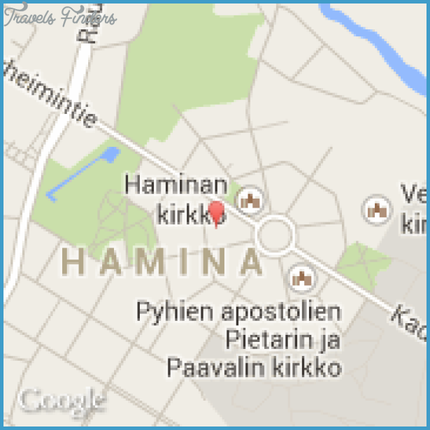
SIGHTS. The central feature of the town is an octagonal square laid out according to a 1723 plan. The square is surrounded by streets on an almost circular layout, with eight streets leading out of the square. In the square stand the Town Hall (built 1798; restored, with the addition of a tower, by C. L. Engel in 1840), the Lutheran Church (1843; in the gardens a memorial to the 1809 treaty) and the Orthodox Church (1837). In the Market Square, to the W, is the octagonal Flag-Tower (1790: small museum), a remnant of the town’s defences. The Municipal Museum at 2 Kadettikoulunkatu occupies a house in which the Empress Catherine of Russia and King Gustav III of Sweden negotiated a treaty in 1783. The old village of Vehkalahti has a fine medieval church (restored 1823).
SURROUNDINGS. Road 7 runs W to Helsinki (150 km 93 miles). 11 km (7 miles) along this road the road from Kouvola enters on the right. From here there is a first glimpse of the industrial town of Karhula, 7 km (41 miles) ahead (pop. 23,000; Kesti-Karhu Hotel,
23 Kymen Motelli, 170 SB). The Sunila cellulose factory in the town was designed by Alvar Aalto. Interesting Glass Museum. 2 km (H miles) farther on a road goes off on the left (6-5 km 4 miles) tothe important port and industrial town of Kotka, on an island in the Gulf of Finland, now linked with the mainland (pop. 34,400; Seurahuone Hotel, 68 Ruotsinsalmi, 54 Koskisoppi, 70 open May-August; two youth hostels). Lying at the mouth of the largest river in southern Finland, the Kyminjoki, the town rapidly developed into a major exporting port. It also has important industries, particularly woodworking. A major naval battle between Sweden and Russia took place off the coast here in 1790. In the market square (large market on the first Thursday of the month) is the handsome Town Hall (by E. Huttunen, 1934). S of the square is the Municipal Park (Kaupunginpuisto), with the Orthodox Church (1795), the only building to survive the British bombardment of the town in 1855. From the old water-tower (62 m 203 ft) and the Norska Berg to the SE there are fine views of the offshore islands. Boat trips to the small rocky islands or skerries are run from the harbour; old fortifications can still be seen on some of the islands. On a nearby island (reached by a side road branching off the road to E3) is the beautifully set fisherman’s hut” of Langinkoski, presented to Tsar Alexander II by the Finnish Senate (now a museum; dramatic performances from midsummer to the end of July). Road 7 continues W via Loviisa and Porvoo to Helsinki (131).
To the E of Hamina the road continues to the frontier post at Vaaimaa and, after 100 km (60 miles), reaches Viborg (Finnish Viipuri). Viborg is the former capital of Finnish Karelia, now in the Soviet Union.
Hamina Fredrikshamn Finland Map Photo Gallery


