
CATALOOCHEE TO BIG CREEK
The land encompassing Great Smoky Mountains National Park hasn’t always looked like the natural oasis it is today. Back in the 1930s, eighteen timber companies owned 85 percent of the park. They were feverishly logging the mountain slopes from the bottom up. The other 15 percent of land consisted of some 1,200 farmsteads and more than 5,000 summer homesites. When the land became public, the government removed hundreds of structures, let thousands of acres of farm fields turn fallow, abandoned thousands of miles of old trails, wagon paths, and logging roads, and took up miles of logging railroad tracks. Entire mountainsides, left bare by the loggers, were either replanted or left to revegetate naturally. In other words, when the park came, this region was just like any other in the Appalachians: Its residents worked the land hard to make a living, and timber and mining companies squeezed what they could from it before moving on to the next location. It was not the vast virgin wilderness so many imagine it to have been.
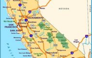
Start out near Interstate 40 and U.S. 276, west of Asheville. Head west onto Cove Creek Road. Drive 7 miles, then turn left onto the paved road. Drive 3 miles, then turn right (straight ahead is Cataloochee Cove). Drive 2 miles, then turn left. Drive 12 miles to the community of Mount Sterling, then turn left onto Big Creek Park Road. Follow it 1 mile to the parking area. (25 miles)
Some 1,200 people lived and worked in Cataloochee when the park came to town, making it the largest settlement in the Smokies. The park removed most of Cataloochee’s two hundred buildings, but those that remain provide a glimpse into the past. There are old frame houses, barns, a church, a school, and a few other structures. A narrow, partly unpaved road winds through the valley, providing access to the historic buildings. High mountain ridges surround the pastoral valley, making Cataloochee among the more scenic spots in the Smokies.
Despite the scenic and historic attributes of Cataloochee, most park visitors ignore the valley in favor of the more accessible and popular areas of the park such as Newfound Gap Road and Cades Cove. Cataloochee lies well off the beaten path and requires a long drive on a winding road. Of course, that’s the perfect type of trip for readers of this book. In recent years, Cataloochee’s visitation has increased dramatically. People come here today to see elk, reintroduced into the park in 2001. If you want to see one of these magnificent animals, get here early in the morning, when a sighting is just about guaranteed. You might even have to stop the car for an elk crossing the road.
From Cataloochee, our route travels on dirt roads to Mount Sterling Gap. Before you reach the gap, a gated side road forks to the left. The road leads to Little Cataloochee. As its name suggests, the ghost town is a smaller version of Cataloochee, which is sometimes called Big Cataloochee. It has a couple of cabins and a church. Scattered all about are subtle reminders that this area was once a thriving settlement. Visitors are welcome, but the road is for hikers and horses only.
At Mount Sterling Gap, a three-mile trail leads to the summit of Mount Sterling, where a historic fire tower provides spectacular views. A designated backcountry campsite lies directly below the tower, giving backpackers the opportunity to watch the sunrise from the tower for an unforgettable experience.
From Mount Sterling Gap, the gravel road descends to the community of Mount Sterling, just outside the park boundary. Nearby is Mountain Mama’s, a community store and classic rest stop for thru-hikers on the Appalachian Trail. Most thru-hikers start in early spring from the southern terminus in Georgia. This takes them along some seventy miles of the Smokies’ crest and deposits them at Davenport Gap, a mile or so up the road from Mount Sterling. By this time, they are exhausted and hungry. Mountain Mama’s might not impress anyone arriving by automobile, but those showing up on foot love it.
Rough Fork Creek flows in front of Caldwell House in Cataloochee Cove in Great Smoky
Mountains National Park.
History and Hiking in the Smokies Photo Gallery


