
Province
Area: 166,OOOsq.km/64,OOOsq. miles Population: 38,650,000. Capital: Nanchang
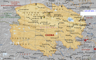
The province of Jiangxi in south-east China, to the south ofthe Changjiang, lies between 113°34′-118°28’E and 24°29′-30o15’N.
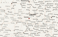
Running through the middle of Jiangxi Province from south to north is the Ganjiang (hence the abbreviation “Gan” for the province) with the largest freshwater lake in China, Poyang Hu (3583sq.km/1383sq. miles). It is surrounded by a plain extending over more than 20,OOOsq.km/77,OOOsq. miles, which to the south, east and west is bounded by mountains as high as 2000m/6500ft.
The climate is very mild, the average temperature in January being 6°C/43°F. The province also has plentiful and regular rainfall.
The area was originally inhabited to a large extent by non-Chinese, but in the 3rd-6th c. was settled by Han-Chinese, who fled there to escape the steppe peoples in the north. During the Ming period (1368-1644) the province emerged with its present boundaries. In the 20th c. Jiangxi was the first power base ofthe communist revolutionaries.
The large coal reserves and deposits of tungsten ore in the Dayu Ling Mountains are important industrially. Kaolin is also mined, with porcelain production in Jingdezhen. The main agricultural product is rice, which is cultivated for 10 to 11 months in the year (wet rice-growing area around Poyang Hu) and occupies 70% ofthe available arable land. Other crops include tea, barley, wheat, sesame, rape, maize and sweet potatoes. Jiangxi is also an important fruit-growing area, producing water melons, pears, date-plums, apples, oranges and the famous pipless mandarin and has a significant forestry industry (cedar, camphor, maple and pine).
The capital Nanchang and the towns of Jingdezhen, Jinggangshan and Juijiang all merit a visit (see individual entries).


