Province
Area: 567,OOOsq.km/219,OOOsq. miles Population: 108,970,000. Capital: Chengdu
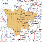
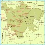
The province of Sichuan lies in the south-west of China, on the upper Situation reaches ofthe Changjiang river, between 97°22′ and 110°10’E and 26°03′ and 34°20’N.
About 109 million people live in Sichuan, making it the most heavily populated province in China. In the western regions are found national minorities such as Yi, Tibetans, Miao, Qiang and Hui. Chongqing is the largest town in the province, followed by the capital Chengdu.
The Sichuan Basin covers an area of 220,OOOsq.km/85,OOOsq. miles and Topography takes up most ofthe eastern region; because of the large amounts of red sandstone found here it is also known as the Red Basin. It is surrounded on all sides by high mountains – by the Yunnan Guizhou plateau in the south, the Dabashan range in the north-east, the Wushan in the east and the edge ofthe Qinghai Highlands in the west. The countryside is hilly – between 400 and 800m/1300 and 2600ft above sea-level – with some sunken plains, particularly the Chengdu Plain in the west.
The continental and monsoon climate means that the plains enjoy mild Climate winters, early springs and long warm summers, with only moderately harsh winters and temperate summers in the higher lands to the southwest, while the inhabitants ofthe mountains in the north-west must endure winter temperatures for most ofthe year. In Chengdu the average January temperature is about 7°C/45°F and that in July 260C/79°F.
The region wasfirst inhabited by Han Chinese in the 4th c. b.c. Until the 10thc. it was an independent kingdom for part of the time and under the control of the central government at other times. After the demise of the Qing dynasty, under which it had attained provincial status, Sichuan was broken down into individual regions. In 1938, after the Japanese invasion, the National Government returned here. It was at this time that industrialisation began with the transfer of many businesses from eastern China, and this trend intensified after 1950.
The fertile soil, mild subtropical climate and rich mineral deposits combine to make the Sichuan Basin the main economic and industrial area of the province. Natural gas, coal, oil, salt, manganese, sulphur and iron-ore are all extracted, while engineering, automobile manufacture, iron-smelting, chemicals, cotton and foodstuffs are the major industries. International tourism is on the increase. In the agricultural sphere rice, maize, wheat, millet, sweet potatoes, sugar-cane, tea, soya beans and groundnuts are all grown. The breeding of silkworms and the raising of pigs and poultry are also of importance. In the west sheep- and yak-breeding play a major role.
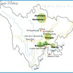
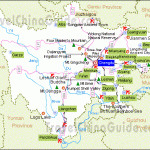
The numerous tourist attractions include Chongqing and the provincial capital Chengdu (see entries).

