
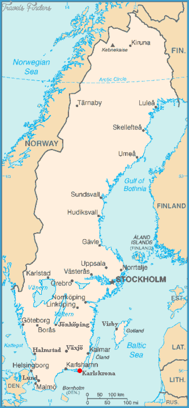
Province: Blekinge Ian. Region: Blekinge.
Altitude: sea level Population: 60,300.
Postal code: S-37 Telephone code: 04 55. Turistinformation,
Stortorget 6,
S-37131 Karlskrona; tel. 8 30 00.
HOTELS. Stadshotelet, Ronnebygatan 37-39,160 Siesta, Borgmastaregatan 5, 29 Wenstrom, V. Kdpmangatan 12, 52 OK Motel, 48 b. YOUTH HOSTEL. Several CAMP SITES.
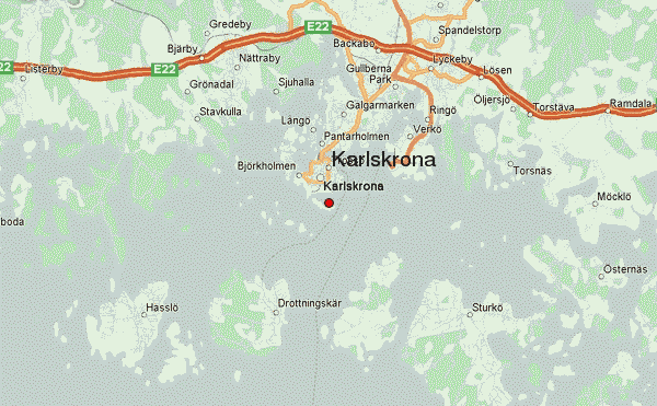
Karlskrona, capital of the province of Blekinge, lies on the Baltic near the entrance to the Kalmar Sound. The town is built on a number of islands linked to each other by bridges. This old seafaring town dates from Sweden’s days as a great power. The town was founded in 1680, when the headquarters of the Swedish fleet were established on the island of Trosso. In the 18th c. Karlskrona was Sweden’s second largest town, but then it declined in importance. It is now a large industrial town (manufacture of telephones, shipbuilding, plastics, construction of atomic reactors, manufacture of electric bulbs), and also has Sweden’s largest cold-store plants and much of its fish-processing industry.
SIGHTS. In the central square, the Stortorg, are the neo-classical Town Hall, the Baroque Frederikskyrka (1744) and the round Trinity Church (1709), which was built for the German community in the town. Both of the churches were designed by Nicodemus Tissen the Younger. In the square, which has a statue of Charles XI by Borjesson (1897), a colourful Flower Market is held four days before Midsummer Eve (June), at which garlands and flowers from the hillsides and meadows of Blekinge are sold.
Farther S, in Admiralitatstorg, the Blekinge Museum houses a collection illustrating the history of the town and province (Baroque garden on terrace). Here, too, is a timber belfry, built in 1700 and restored in 1 856. Also to the S of the town is the Shipping Museum, with a collection of famous figureheads of the late 17th c. and much more. Near the shipyards stands the Admiralty Church (1 685), the largest timber-built church in Sweden. In front of it is an appealing wooden figure of Old Rosenbom”, a character in Selma Lagerlof’s book The Wonderful Journey of Nils Holgersson. In the Bjorkholmen district, to the E, are picturesque little 1 7th c. seamen’s houses.
In Vano Park is an open-air museum.
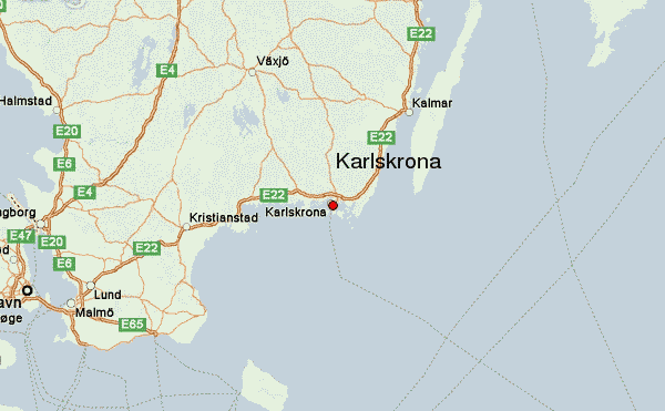
SURROUNDINGS.-28 km (17 miles) Ewe come to Ronneby (pop. 12,000), a spa with chalybeate (iron-bearing) springs. Holy Cross Church (Heliga Kors kyrka, 11 th c. 14th-15th c. frescoes, brought to light during restoration work). A door bearing the marks of burning and axe strokes is preserved in the church; it is believed to date from 1564, when the troops of Eric
XIV ravaged the town. Near the church, in the district of Bergslagen, is a local museum, MollebackagSrden. In Silverforsen, an old Blekinge farmhouse serves coffee. The Bjorketorpssten is an interesting runic stone (c. 700). There are other burials at Hjortaham-mar. 61 km (38 miles) E of Karlskrona is Karlshamn (pop. 18,000; Esso Motor Hotel, 195 b.), a port town of some importance. The old town has 17th and 18th c. timber houses, including the Asschiersska Hus, built in 1682 as the Town Hall, and the Skottsberskagcirden, an excellently preserved merchant’s house (c. 1760). One old house, Smith-skagSrden, is now a museum. In the Hamnpark a monument by Axel Olsson, ‘The Emigrants Kristina and Karl Oskar”, recalls Karlshamn’s role as the port from which many Swedes emigrated to America in the 18th c. On the island of Kastelholm, outside the harbour entrance, are fortifications built in 1675. To the E of the town lies the Vaggapark, a pleasant recreation area. The Morrumsa, the best salmon-fishing river in Sweden is near here. To the W of the town can be seen the Karlshamn nuclear power station.
Karlskrona Sweden Map Photo Gallery
