
Province: Pohjois-Karjalan laani (Norra Karelens IanNorthern Karelia).
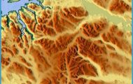
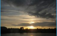
The Koli Hills, one of the most attractive areas in Finland, lie on the SW shore of Lake Pielinen, on the NE fringe ofthe Finnish Lake Plateau.
AxAhmovaara, on Road 18, which runs N from Joensuu, a side road goes off on the right and runs through rocky and partly wooded country to a parking place at the Koli Hotel (84 Finnish sauna, SP). From the S side of the hotel a stepped footpath ascends the rocky Ukko-Koli (347 m 1139 ft). From the top of Ukko-Koli there is a magnificent view of Lake Pielinen 253 m (830 ft) below, with its numerous wooded islands. To the S are two other peaks in the Koli Hills, Akka-Koli (339 m 1112 ft) and Paha-Koli (334 m 1096 ft). To the N is Ipatti (316 m 1037 ft).
There are more than 20 km (12 miles) of footpaths and some facilities for winter sports in the area around the hotel. 10 km (6 miles) N is the Loma-Koli vacation area, with a hotel, chalets and a camp site.
