
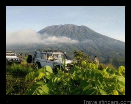
Kudremukh is a picturesque mountain range located in the lush green region of the Western Ghats, and cuts across the districts of Dakshina Kannada, Udupi and Chikmagalur in Karnataka. Situated at an average height of 1,894 m above sea-level, the mountain range here is known by the name Kudremukh, which literally means ‘horse face’, because the main peak resembles the face of a horse. These mountains are well known for scenic landscapes, trekking trails and numerous waterfalls. The Kudremukh area is rich in iron ore deposits. It is primarily an iron ore mining town where the government runs the Kudremukh Iron Ore Company Ltd.
Reaching there:
By Air – Mangalore-130 km
By Rail -Mangalore-130 km
By Road: Mangalore-130 km Bangalore- 350 km
Attractions
Kudremukh National Park
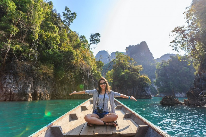
Declared as a wildlife protected area, the park is a tropical wet evergreen forest. Lush forests, long winding rivers, grassy slopes and enchanting cascades make this an excellent trekking destination in the Western Ghats. For the adventurous, there are lots of trekking routes that crisscross across the National Park. As far back as in 1916, Kudremukh was declared as a Reserved Forest to stop deforestation. In 1987, the Government of Karnataka declared these Reserved Forests as a National Park. The mammals found here are the tiger, leopard, wild dog, jackal, macaque, sloth bear, gaur, sambar, spotted deer, barking deer, Malabar giant squirrel, porcupine, giant flying squirrel and the mongoose. Reptiles found here are snakes and tortoises. The Malabar trogan, great pied hornbill, Malabar whistling thrush and the imperial pigeon are found here. The best season to visit this place is from October to May, when everything is lush green and the rivers, waterfalls and streams are at their best.
Jamalabad Fort
This fort, built by Tipu Sultan in 1794, was named after his mother Jamalabee. It is
1788 m above sea level and was formerly called Narasimha Gada. It is also referred locally as ‘Jamalagada’. The fort is accessible by a narrow path with nearly 1876 steps. Inside, one can find two small fresh-water springs and some tanks which were used to store water.
Lakya Dam
Lakya Dam is built on River Lakya which is an offshoot of River Bhadra. The dam is nearly 100 m high. This is an interesting spot in the Kudremukh range.
Kadambi Falls
A beautiful waterfall located nearby, where water gushes down from a height of over
100 ft.
Around Kudremukh
Kalasa
About 20 km away is Kalasa, a hill station with picturesque views and beautiful surroundings. It is also a holy temple town where the Kalaseshwara Temple is located.
Horanadu
About 28 km from Kudremukh is Horanadu, a holy temple town. The historical temple of Goddess Annapurneshwari is located here amid picturesque surroundings. The legend says that a person who seeks the blessings of Annapurneshwari would never be short of food.
Hanumana Gundi Waterfalls
Situated 32 km from Kalasa, Hanumana Gundi waterfalls is a place where water gushes down from a height of 100 ft, amidst picturesque surroundings.
Sringeri
Located at a distance of about 50 km, amidst the Sahyadri Hills in Chikmagalur district on the left bank of the River Tungabhadra, Sringeri is home to the Sharada Peetham, established by the revered spiritual guru Adi Shankaracharya. The Vidyashankara Temple here was built in the 14th century and displays both Hoysala and Dravida styles of architecture. It is an architectural marvel – its 12 sculpted pillars, each representing a sign of the zodiac, are placed such that the sun’s rays fall on each in the order of the solar months.
For more information, contact:
The Director, Department of Tourism
# 49, Khanija Bhavan, Second Floor, Race Course Road, Bangalore-560 001,
Karnataka, India. Tel: 080 2235 2828 Fax: 080 2235 2626
Email: info@karnatakatourism.org, http://www.karnatakatourism.org
Tourist Officer, Department of Tourism, Dr Ambedkar Road, Near BSNL Office, Chikmagalur 577 101, Tel: 08262 228 493
Kudremukh Photo Gallery
