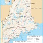
Maine Map
WHITE MOUNTAIN NATIONAL FOREST
49,000 acres in Maine (798,000 acres in New Hampshire). While most of this National Forest is located in New Hampshire, a sizable tract is in Maine, along the state’s western border. The area has a number of rocky peaks and other wild mountain scenery.
Included is 2,906-foot Speckled Mountain, which is in a designated wilderness area: the
12,000-acre Caribou-Speckled Mountain Wilderness. There are hardwood forests with spruce and fir, meadows, streams, waterfalls, and some lakes and ponds.
Activities: This district of the forest has about 160 miles of trails for hiking and backpacking. Cross-country skiing and snowshoeing are available here in the winter. Fishing is also possible. Hunting is permitted in season.
Camping Regulations: Camping is allowed throughout most of the National Forest, except where otherwise prohibited. Campfires are legal but discouraged. Use of a stove is recommended for cooking. No permits are necessary.
Six backcountry shelters are located along several of the trails. When staying at other than established sites, campsites should be at least 200 feet from streams and trails. Group size is limited to a maximum of 10 in the wilderness area.
Camping and fires are restricted in some areas (Restricted Use Areas). Camping is not permitted within one-quarter mile of designated camping areas, roads, trailheads, or above treeline (or where trees are under eight feet tall), except on two feet of snow.
For Further Information: White Mountain National Forest, RR 2, Box 2270, Bethel, ME 04217; (207)824-2134.

