
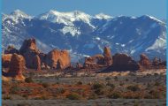
1,415 acres. Washington State Park is located in the Ozarks of east-central Missouri, alongside Big River. This is an area of oak-hickory forest, with rough terrain including rocky outcrops.
Activities: Hiking and backpacking are possible on 14 miles of trails. Longest is the circular 10-mile Rockywood Trail.
Camping Regulations: Camping is allowed on the western part of the Rockywood Trail loop. There’s one designated camping area, and use of this area is required for groups of seven or more. Campsites elsewhere along the Rockywood Trail must be at least 100 feet from the trail, 200 feet from public use areas, and one-quarter mile from entry points. Campfires are not permitted.
For Further Information: Washington State Park, De Soto, MO 63020; (314)586-2995.


