
Not far west of West Yellowstone, Montana, on U.S. Highway 20 is Targhee Pass, used by the Bannock tribe on their annual trek to hunt buffalo. South of the pass is a wide fertile valley, a checkerboard of private and national forest lands. State parks near Henrys Lake and Island Park Reservoir offer camping and hiking possibilities and fishing for trout and whitefish. Harriman State Park on Island Park Reservoir is an important wintering spot for trumpeter swans and home to a variety of other wildlife. The park also has a visitor center and over 20 miles (32 km) of trails. In describing a trail running along the west boundary of the park, Carl Schreier, in his book Hiking Yellowstone Trails, tells us: This side of the park boundary is easy to keep track of because the forest is clear-cut up to the edge of the park. From outer space, this is the second most visible man-made feature on earth. The most visible is the Great Wall of China. However, the Forest Service has done considerable replanting in Caribou-Targhee National Forest. Traveling along U.S. 20 between West Yellowstone and Ashton, Idaho, you might take one or both of the following side excursions in the national forest.
The Bechler Region and Environs Side excursion to Big Springs A side road leading east from U.S. 20 at the tiny town of Macks Inn takes you in 3 or 4 miles (5-6 km) to Big Springs, the major source of Henrys Fork of the Snake River and a truly beautiful spot. Small rafts or boats without motors may use part of the river, and there’s a trail along it. Side excursion to Mesa Falls For a delightful short trip very close to the western edge of Yellowstone, visit Upper and Lower Mesa falls on Idaho Highway 47. These two beautiful waterfalls on Henrys Fork cascade over the edge of lava that flowed from the Yellowstone caldera over half a million years ago. This lava flowed over the eastern section of a much older, similar crater, the Henrys Fork caldera [GEO.8]. (For an explanation of these calderas, see the Geological Historychapter.) To reach Upper and Lower Mesa falls from the north, take Idaho 47, which intersects U.S. 20 about 36 miles south of West Yellowstone. Coming from southeastern Idaho, go east from Ashton about 5 miles (8 km) and then north on Idaho 47. The 114-foot (35 m) Upper Mesa Falls is about 12 miles (19 km) from the U.S. 20 turnoff. Following the short trail leading to the falls, you stand above its exhilarating roar. The Big Falls Inn has been reconstructed as an interpretive center, with full access for wheelchairs. Major improvements to the inn building, the trails and boardwalks, and the intrepretive signs have necessitated an entrance fee of $3 per car.
A short distance south of Upper Mesa Falls is the turnoff for the less spectacular, 65-foot (20 m) Lower Mesa Falls, with its attractive 1930s stonework. There are three Forest Service campgrounds along Idaho 47. Near Warm River, the road drops steeply over the Island Park caldera rim. The contrast between forested mountain terrain and gently rolling farmland is sudden and striking. Potatoes, barley, and alfalfa are grown in these fertile plains. To the east you’ll catch Upper Mesa Falls waters a lush green views of the Tetons. garden of moss. Big Springs harbors islands of flowers. Continuing to the Bechler Region About 6 miles (9.5 km) east of Ashton on Idaho 47, Green Timber Road goes east. Take Green Timber Road to reach the Bechler Region of the park in about another 17 miles (27 km). Before long, the pavement changes to a good quality gravel surface, just as you enter Caribou-Targhee National Forest. You cross into Wyoming just before reaching the roads leading to Bechler Ranger Station and Cave Falls. The Bechler Region, or Cascade Corner, and Its Water Named for Gustavus Bechler, a topographer who entered the area with the 1872 Hayden Expedition, the Bechler Region is best characterized in one word: water. Streams and marshes are everywhere. The park ranger at Bechler remarked on June 30 in a recent year: Bechler Meadows is a lake! The whole corner abounds in waterfalls. Within a 10-mile (16 km) radius of Bechler Ranger Station are Cave, Bechler, and spectacularly beautiful Union Falls (250 ft/76 m high), as well as Rainbow, Iris, Colonnade, Ouzel, Dunanda, Silver Scarf, and Terraced falls.
Farther along the trails are others too numerous to mention. The drawbacks to all this water are several: hikers must wait until the latter part of the summer to enjoy the area and even then must be prepared to ford streams that may be as deep as mid thigh and mosquitoes and other pesky insects like it here, too. Fortunately, they die off in late summer. In the 1920s, this copious supply of water inspired repeated proposals to dam the Bechler or Fall rivers and deliver the water to Idaho farmers, allowing the use of Yellowstone Park water for irrigation or even removing the Bechler Region from park territory. But Yellowstone’s supporters were successful in defeating the several bills and amendments introduced in Congress. Around the same time, a member of the National Parks Association, writing about his exploration of the area, stated a bit cheekily: Persons living near a national park who feel themselves harmed by their situation must bear their burden cheerfully (quoted in The Yellowstone Story by Aubrey L. Haines). Idaho potato farmers get water instead from Grassy Lake Reservoir (built in the late 1930s) and from Jackson Lake.
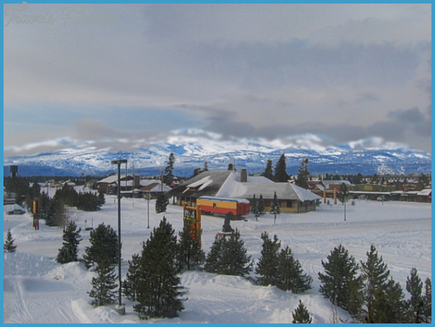
FROM WEST YELLOWSTONE OR ASHTON TO THE BECHLER REGION Photo Gallery


