
Agios Neofytos encleistra
Lempa archaeological site
The visitor can observe, however, the successive strata of mural paintings. The 17th century iconostasis contains some icons dated 1736 A.D. with an earlier one belonging to Saint Symeon Stylites. A noteworthy icon is that of Christ holding a Gospel in his left hand. Some specialists consider this icon as one of the most beautiful icons of Cyprus. The paintings are very interesting with the impressive Christ Pantokrator on the dome surrounded by Angels. A fresco representing the miracle of fishing is worth noting. In the boat, there are six apostles carrying a net full of fish, while before Christ kneels Peter. About 150 metres east of the village, following a narrow track, the visitor can reach a vaulted chapel dedicated to St George. Traces of paintings, belonging to the 16th century, prove that the chapel was originally entirely covered with paintings. The sanctum is square, round a holy stone altar. Three recesses in the north, south and east wall were most probably used as tombs. The chapel lies close to a rocky surface, surrounded by asphodels, cyclamens and giant fennels. Lempa, about 5km north of Pafos, is a beautiful small village with some peculiarities. The village is well-known in the art circles because here artist Stass Paraskos founded the Cyprus College of Art, accepting and training art students from all over the world. Lempa is also widely known because of its Chalcolithic settlement of 3500-2500 B.C. at the locality “Lakkous”. The visitor will be able to observe the circular buildings which were supported by posts. They were inhabited by a farming community which cultivated wheat, barley, olives, grapes and legumes. It is remarkable that the prehistoric people of Lempa had overseas contacts and they had developed artistic and religious traditions. They buried their dead underneath the floor or just outside. They used stone axes for the clearing of forests, adzes for carpentry and mortars and querns for grinding cereals, lentils, etc. Archaeological excavations are still going on in the village. The visitor will be able to see, on spot, a restored village of the Chalcolithic period with all details concerning the construction of houses and the material used. Kisonerga is rich in physical and cultural features. Close to the church of Transfiguration lie the ruins of a tiny chapel dedicated to Zinovia and Filonilli. These two saints, close relatives of St Paul, accompanied him from Tarsus to Pafos and worked with him for the spreading of Christianity . They died and were buried at Kisonerga while St Paul was at Pafos. The holy well, mentioned by Tsiknopoullos and Gunnis, cannot be traced close to the single-aisled chapel. The deep roots of the village lie at the locality Mosfilia where a prehistoric settlement has been unearthed dating back to the fourth millenium B.C.. Circular houses with a very large diameter have been unearthed. The roofing of such huge buildings no doubt presupposes special architectural knowledge. A cobbled road discovered supplies insights into public enterprise and communal organisation in Cyprus about 3000 B.C. Moreover, excavations at another locality “Myloudkia” yielded painted stone work and other evidence of the early Chalcolithic period. Recent excavations at Myloudkia brought to light findings which permit the dating of the settlement to as back as 8300 B.C. that is 1000 years earlier than the settlement of Choirokoitia. Potima, a huge estate in Frankish times, was converted to a chiftlik during the Turkish period. It was expropriated by the British Government in 1945 and later redistributed and rented to landless or small holders from Kisonerga and
Cyprus map | Where is Cyprus | Location and map of Cyprus Photo Gallery


Pegeia. In the south-eastern corner of the chiftlik, known as “klidotoudes”, there are fossils of pigmy hippopotamus (Hippopotamus minutus), which lived in Cyprus until recent geological times. The animals lived close to a shallow lagoon, that existed during the Pleistocene era. Most probably abrupt climatic changes brought about the extermination of the animals. Currently, if you dig a few centimetres in the soil, you will find fossils of this pigmy hippopotamus.
Map of Cyprus | Cyprus Regions
Coral bay
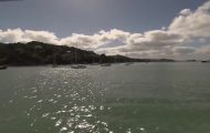
Coral Bay is a horse-shoe cove with its edges ending in abrupt cliffs, while in the middle an extensive fine-grained sandy beach is bordered by the rock of coral limestone. On the northern edge of the cove, which is a tiny peninsula with cliffs on three sides, the ancient settlement of Maa-Palaiokastro has been unearthed, which dates back to the 13th century B.C. Achaean settlers, after the decline of Mycenean centers in Peloponnisos (Morea), arrived in Cyprus, mainly attracted by its copper mines. The archeological excavations unearthed a large architectural complex comprising large as well as small rooms communicating by a common corridor. They chose this strategic position to build their fortified settlement, which was, however, soon abandoned, most probably in the first decades of 1200 B.C. The Museum of Mycenean Settlement located in the area exhibiting Mycenean finds and various charts indicating internal and external trade during that period. The Mycenean settlements at the end of the Bronze Age (13th – 1th c. B.C.) are also indicated. It is worth visiting the museum on a site that was considered excellent vantage point from which to survey any approach by land or sea. Pegeia, about 5km north-east of Coral Bay, has grown around a spring, the much-sung “Spring of Pegeia Women”. The spring preserves its arches and a stone-built tank where adequate quantities of water could be stored. About 3km west of Pegeia there was in the past the monastery of the Allholy Virgin Mary Zalagiotissa. Currently, only the place-name is preserved. Northwest of the Coral Bay, within the administrative area of Pegeia, lies Keratidi, a tiny shelter from where, until recently, large quantities of carobs were exported. Presently, only the ruined store-houses are preserved. About 2km north of Pegeia, on the way to Kathikas and the Laona plateau, lies the small forest of Pegeia covered with juniper and pine-trees. On the way to Agios Georgios isle, lies the Paphos Zoo where visitors can observe a wide range of exotic animals such as birds, zebras, giraffes, gazelles, lions, tigers and many more.
Sea caves (Kantarkastoi) at Pegeia
Kantarkastoi Caves or Pegeia Sea Caves. An earthen road left of a new tiny settlement (with the same name), on the Pafos-Agios Georgios road, about 2km south of Agios Georgios church (Cape Drepano), leads to the most spectacular sea caves of Cyprus, known as Kantarkastoi caves or sea caves of Pegeia. Cracks and joints in the strata of the chalky rocks encouraged the waves to open caves which now constitute labyrinthine formations, with some of them communicating inside. Until sixty years ago, as the locals say, there were a few seals living in the caves.
Road Map of Cyprus | Tourist Map of Cyprus | Maps of Districts in Cyprus
Agios Georgios isle (Pegeia)
Agios Georgios. About 8km north-west of Pegeia, the traveller will encounter a tiny settlement with cafes, restaurants, a few isolated households, a hotel and a modern, whitewashed church dedicated to St George. The church is much venerated by the people of the surrounding villages. Below the surface on which the church stands there is a fishing-shelter with a few colourful fishing boats. The tiny beach close by caters for the swimmers who arrive there in hundreds during the summer months. Just opposite, in the sea, lies the picturesque isle of Geronisos or isle of Agios Georgios, at a distance of about 300 metres. The fauna of the isle consists of sea-gulls, rock doves and a few serpents, while the flora consists of lentisk, thyme and various herbs. Besides, on the isle there are wells, cisterns and foundations of houses, most probably of an ancient public building. Most of the findings, so far, belong to the Hellenistic period, though it is strongly believed that at the end findings from the Chalcolithic period will be unearthed as well. Archaeological excavations revealed that Apollo was worshipped in Geronisos. A series of early
Christian rock-cut tombs below the cliff, with rectangular or vaulted openings, belong, most probably, to early Christians or hermits. From the cultural point of view the most impressive site in the area are the three basilicas of the 6th century A.D. close to the church of Agios Georgios. The middle one, of large dimensions, preserves beautiful mosaics with animal, bird and fish representations as well as other geometric shapes. The baptistery, the columns, the underground reservoir where rain water gathered, the bath complex with cold and warm water as well as the mosaics, are the findings of the latest excavations. From the excavations, still in operation, it is, so far, concluded that the settlement was at its growth during the late Roman-early Christian period, but did not survive the Arab raids of the 7th century A.D.
c) South-eastern coastal plain of Pafos town
Route: Geroskipou, Agia Marinouda, Koloni, Acheleia, Agia Varvara, Timi, Pafos International Airport, Mandria, Achni, Petra tou Romiou


