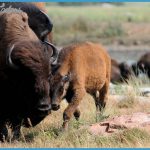
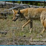
As you pass the ranger station and Yellowstone Institute buildings you might ponder the coexistence in the Lamar Valley of three of Yellowstone’s larger mammals. This was the site of the Lamar Buffalo Ranch from 1907 into the 1950s, a part of the park’s efforts to revive the population of the nearly extinct buffalo (called that when the park was new, although zoologists prefer to call them bison). Here the animals were kept in corrals and were fed hay cut in the valley. The imported plains herd interbred with native mountain bison, and some of their descendents live in the park today. Wolves lived here at the park’s founding but were systematically exterminated as undesirable predators. In the mid 1990s a few Canadian wolves were brought to the park, some of them to an acclimatization pen located on Rose Creek, just a mile or so above the Yellowstone Institute cabins. In the valley, you’re still more likely to see a coyote than a wolf.
Wolves will kill coyotes that are competing for food, and when the wolves were reintroduced, they began to make an immediate difference in the park’s coyote population. Coyotes may be almost anywhere at almost any time of day, hunting small prey and carrion. They have little fear of man and may attack people if habituated to them. There’s more about all these animals in the Living Things chapter. Special Caution: Do not feed any animals in the park. It can be dangerous for you and for them. Four cowboys rounding up a bison in the Buffalo Ranch corral in 1935, by Jack Haynes. 19.3/9.3 I Lamar Valley view. Ifyou’re traveling toward the Northeast Entrance along the main road, you have a long, beautiful view here of nearly 20 miles up the valley to Saddle Mountain and other peaks in the Absaroka Range near the eastern boundary of the park. Several miles beyond Saddle Mountain is a remote area first described by Superintendent Norris, after exploring it in 1880; he named it Hoodoo Basin. Haynes Guide described tall, massed eroded rock pinnacles, which reveal to those who let loose their imaginations a large variety of forms of humans and beasts. (There’s more about hoodoos on s 156-57.) 20.8/7.8 East end of Lamar Canyon. In 1885, Historian Hiram Chittenden described Lamar Canyon’s many boulders as almost spherical in shape, and, in many instances as smooth as if from the hand of a stone glazier.
They are piled up like billiard balls, to such a depth that the stream flows entirely out of sight beneath them. The large outcrops along the road [GEO.1] in this canyon consist of rocks that are among the oldest in the park, about 2.7 billion years old. In fact, there are few areas in the world where older rocks are exposed. These rocks are granites and gneisses, formed deep within the earth at a time when a mountain range was being made above them. Those mountains have long since eroded away. 21.7/6.9 West end of Lamar Canyon. 22.8/5.8 @ 0 S Side road to Slough Creek Campground and Buffalo Plateau and Slough Creek trailheads, with several bird-watching spots from turnouts. At this unimproved campground are 29 nonreservable campsites located about 2 miles (3 km) up the Slough Creek road. I S To take one of the two trails, stop at the parking area before the campground. The Buffalo Plateau Trail goes north to join several other trails in the Absaroka-Beartooth Wilderness. A 21-mile (34 km) loop goes from the Slough Creek Campground out of the park and back in, joining the Hellroaring Creek Trail west of Tower Junction. The Slough Creek Trail is popular with fishermen. A hike of about 4 miles (6.5 km) round trip (sometimes steep) takes you through thriving wild-flowers to tranquil First Meadow (as fishermen call it), where a patrol cabin for rangers’ use is located. The Slough (pronounced SLOO) Creek Trail has an unusual reason for being. Just north of the park boundary is the private Silver Tip Ranch, homesteaded in 1913, which is now accessible by air but was previously only reached by this trail or wagon road.
At a point called the Slough Creek Transfer, supplies for the ranch are still transferred from trucks to horsedrawn vehicles kept just for traversing a particularly bad section of road through the meadows. Even now, you may see stagecoaches or wagons as you hike this trail. 23.3/5.3 Lamar River bridge and mouth of Crystal Creek, which enters the Lamar River from the south. 23.6/5.0 On an unmaintained trail, you can ascend the ridge to your south, following Crystal Creek to see some petrified trees on Specimen Ridge. Because it’s a strenuous hike and the trees are not easy to find, get a map and instructions from the Tower Ranger Station before you go. Better yet, go with a ranger or other knowledgeable person.

