
Map by Robert A. Chadwick. Adapted with permission from Geological Society of America Bulletin, Vol. 81, Jan. 1970. of Wapiti, the road goes close enough so that you can see how the flat-lying layers of pebbly rock alternate with finer-grained sandy layers. About 20 miles (32 km) northwest of these roadside formations is another extensive area of hoodoos called Hoodoo Basin. It’s in a remote spot near Yellowstone’s eastern border. An easily accessible place to see hoodoos inside the park is at Devil’s Den just north of Tower Fall. In about 2 miles (3 km), you’ll find the Wapiti Ranger Station, which dates from 1903-4 and is the oldest in the U.S. built with government funds. Midday tours of the old ranger station are sometimes offered. There’s also an information center close to the road. The nearby wayside exhibit commemorates 100 years of the U.S. Department of Agriculture Forest Service, 1891 to 1991.
The rangers at Wapiti Ranger Station will give you information about the nine forest service campgrounds along this road, backcountry trails in the area, and recent bear sightings. For a few miles after the ranger station, the valley widens, making room for many guest ranches. There are no more hoodoos for a stretch. This area was severely burned in the 2008 Gunbarrel fire. Near Rex Hale Campground is a site called Mummy Cave (not open to the public), where archaeologists have discovered evidence that Native Americans lived here sporadically for about 9000 years. In the same area are a few petrified trees, turned to stone by the same geologic events that created similar petrified trees in the park itself. The last two easy-to-find hoodoos near the road are Elephant Head and Chimney Rock. About 2 miles (3 km) east of Yellowstone’s boundary, the road crosses the North Fork of the Shoshone, which it’s been following since Cody. From here into the park, we ascend Middle Creek, centered between other North Fork tributaries called Jones Creek and Eagle Creek.
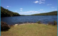
You pass Sleeping Giant Campground and ski area (for cross-country and downhill skiing) and historic Pahaska Tepee, Buffalo Bill’s hunting lodge, 100 years old in 2004 and now open for free tours. The road from Cody is kept open this far all winter. The lodge’s associated cabins and restaurant are the last facilities before entering Yellowstone. Chimney Rock has eroded away from its neighboring cliff. From the East Entrance to Fishing Bridge Junction The East Entrance Road is most noted for passing among high mountains and over Sylvan Pass as well as for spectacular views of Yellowstone Lake and of nearby mountain ranges. Sparkling Eleanor and Sylvan lakes catch your eye at the top of the pass, and farther along are viewpoints from which you can often see all the way to the Tetons. Before reaching Fishing Bridge, the road closely follows the lakeshore. It’s 26 miles (42 km) from the East Entrance to Fishing Bridge Junction.
NOTE: Parts of this road will experience major road work through 2008. Check with Yellowstone authorities before you go. Special Caution: Much of the area accessible from the East Entrance Road, especially around the Pelican Creek drainage, is prime grizzly bear territory in the first half of the summer, when the bears are feeding on spawning trout. It is prudent to check with rangers before hiking and never to hike alone.
Extent of Absaroka Volcanics Photo Gallery


