
(Jarvi-Suomi Finska Sjoplatan) Finland (Central)
Provinces: Hameen laani (Tavastehus lanHame), Kymen laani (Kymmene lanKymi), Mikkelin laani (Sankt Michels lanMikkeli), Keski-Suomen laani (Mellersta Finlands IanCentral Finland), Kuopion laani (Kuopios IanKuopio) and Pohjois-Karjalan laani (Norra Karelens IanNorthern Karelia).
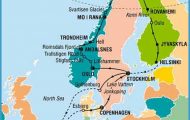
The ‘Finnish Lake Plateau, with its intricately patterned lakes and thousands of islands, covers almost a third of Finland’s total area, earning it the name of the Land of 60,000 Lakes. To the E the lakes extend to the Soviet frontier; on the S they are bounded by the massive terminal moraines of Salpausselka, and on the IM by the barrier of Suomenselka, which forms the watershed between the Gulf of Bothnia and the
Gulf of Finland. The harmonious mingling of woodland and water makes this region a paradise for nature-lovers and boating enthusiasts.
Within this extensive area there are three main drainage basins, loosely connected with one another. To theW, N of Tampere, is the smallest ofthe three, Nasijarvr, in the middle the long straggling Lake Paijanne] and to the E the large Lake Saimaa, which is drained into the Soviet Union by the Vuoksen. All these lake systems lie some 76-78 m (250-255 ft) above sea level.
The Finnish Lake Plateau is traversed from S to N by three important roads, linked by a number of transverse connections. E4 runs along the western edge of the lake region from Lahti by way of Jyvaskyla and Karsamaki to Oulu; Road 5 runs through the middle of the region from Lahti to Mikkeli and Kuopio; and Roads 6 and 18 run in a wide arc round the eastern edge of the plateau via Lappeenranta and Joen-suu to Kajaani and Oulu.
Lahti to Oulu via Jyvaskyla (E4). Lahti ( 167) lies at the southern tip of Vesijarvi (area 113 sq. km 44 sq. miles), which forms the S end of Lake Paijanne. In the northern outskirts of the town Road 5 branches off E4 on the right and runs NE to Mikkeli on Lake Saimaa. E4 continues through hilly and wooded country to the little town of Vaaksy (Tallukka Hotel, 288 SB), where there is a swing bridge over the Vaaksy Canal, constructed in 1871 to link Vesijarvi with Lake Paijanne, 4 m (13 ft) lower (lock). The road now follows the western shore of this lake.
Lake Paijanne, lying 78 m (255 ft) above sea level, is 140 km (87 miles) long and up to 28 km (17 miles) wide, with an area of some 1111 sq. km (430 sq. miles) and a maximum depth of 93 m (305 ft). Its shores are wooded and for much of the way rocky and rugged. Immediately beyond the swing bridge, Road 314 goes off on the right to Arsikkala (pop. 7600), continuing over the narrow isthmus of Pulkkilanharju, 6-5 km (4 miles) long, to the E side of Lake Paijanne and then running N alongside the lake to Sysma (pop. 7000; llolan Kartano Hotel, 39 camp site), which has a stone-built 1 5th c. church.
20 km (12 miles) beyond the turning for Arsikkala E4 reaches the village of Padas-joki (pop. 4800; Nelosmutka Hotel, 18 camp site; two holiday bungalow villages), and then continues via Kuh-moinen to Jamsa (pop. 12,000; Motelli Martin, 50 Monrepos Hotel, 45 camp site), an industrial town (paper-mill) at an important road junction, where Road 9 (E80) goes off on the left to Tampere ( 262). E4 continues via the beautifully situated village of KorpH-ahti. (Turistikeidas Pyhimys Hotel, 24 camp site) to Muurame, which has a church designed by Alvar Aalto. A short distance beyond this, off the road to the right, is the village of Saynatsalo, with communal offices by Alvar Aalto. E4 then comes to Jyvaskyla ( 1 53), beautifully situated on the northern shore of Jyvasjarvi. From here Road 9 runs E to Kuopio. E4 continues N, past a side road (No. 13) tothe attractively situated village of Saarijarvi, on to the recently developed little town of Aanekoski, 1-5 km (1 mile) on right (pop. 11,000; Hirvi Hotel, 50 youth hostel; camp site): woodworking industry, hydroelectric power station on the river flowing out of Lake Keitele. 8 km (5 miles) SE is the busy little industrial town of Suolahti (pop. 6200; Keitele Hotel, 40 b.).
E4 continues via Konginkangas (a little way off the road) to Viitasaari (Pikhuri Hotel, 72 Rantasipi Ruuponsaari, 212 youth hostel; several camp sites), on an island at the N end of the much ramified Lake Keitele (over 80 km (50 miles) long). To the N of the village, which is reached on a causeway, is a lookout tower, Pleasant boat trips on the lake (good fishing).
Finnish Lake Plateau Map Photo Gallery


